SSG 12: The Archer Ave Extension (Updated)

The 1967 Chrystie St Connection marked a new era for the NYC Transit Authority (TA) in terms of subway construction—at least the attempt at such. Following the connection, in 1968, came the Program for Action, which included plans for the construction of the Second Avenue Subway, 63rd St Tunnel, Queens Super Express, and the Archer Ave Extension.

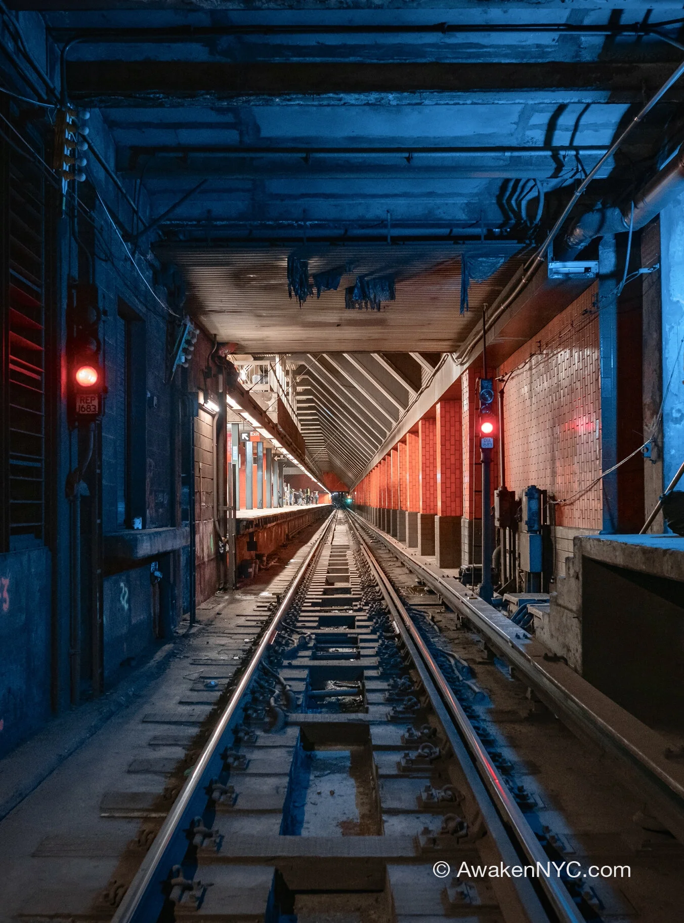
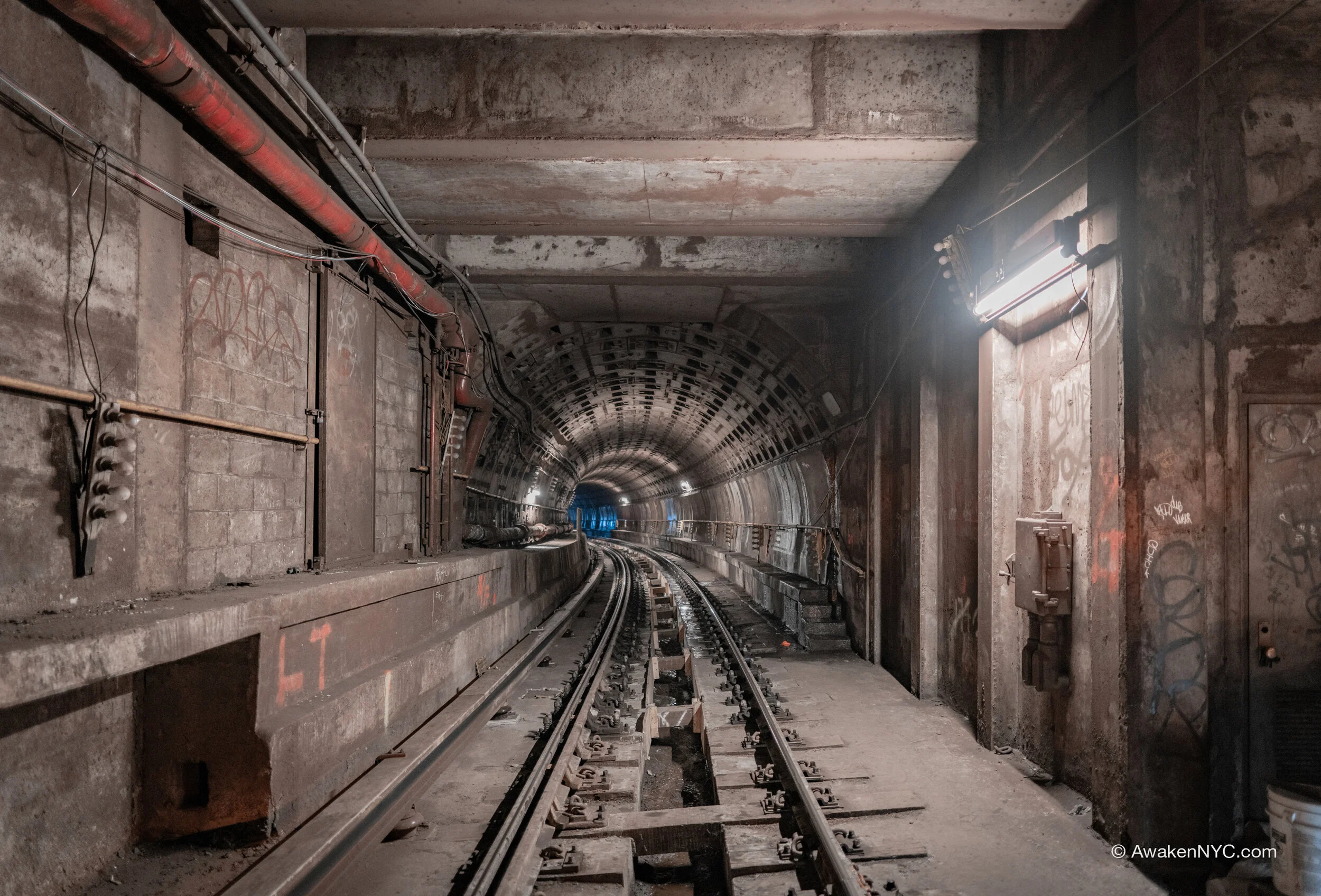
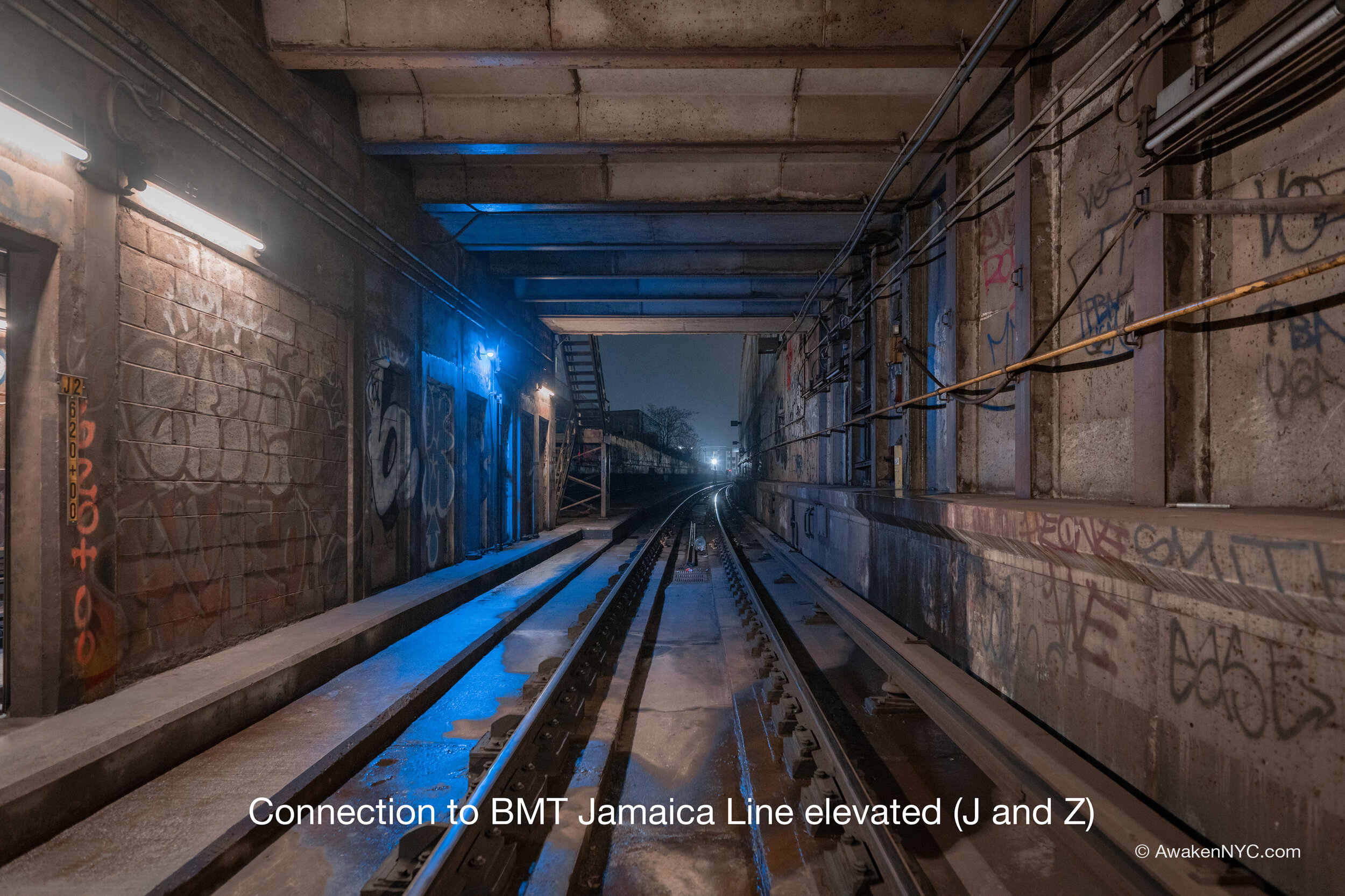
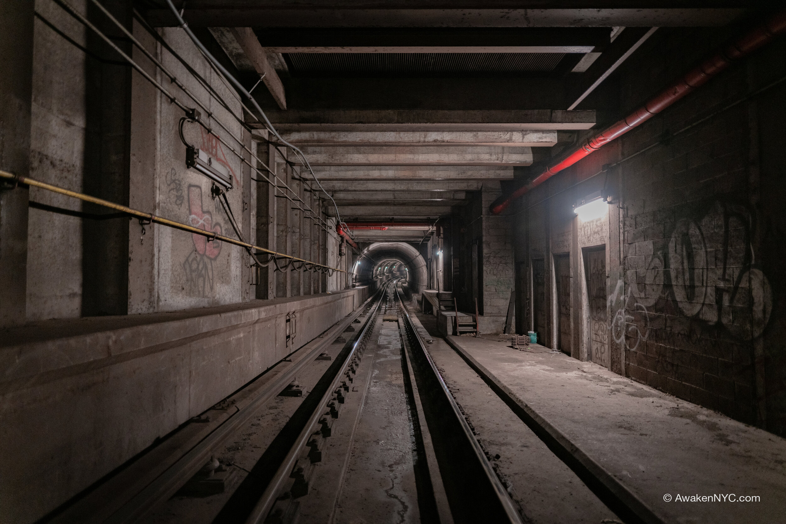
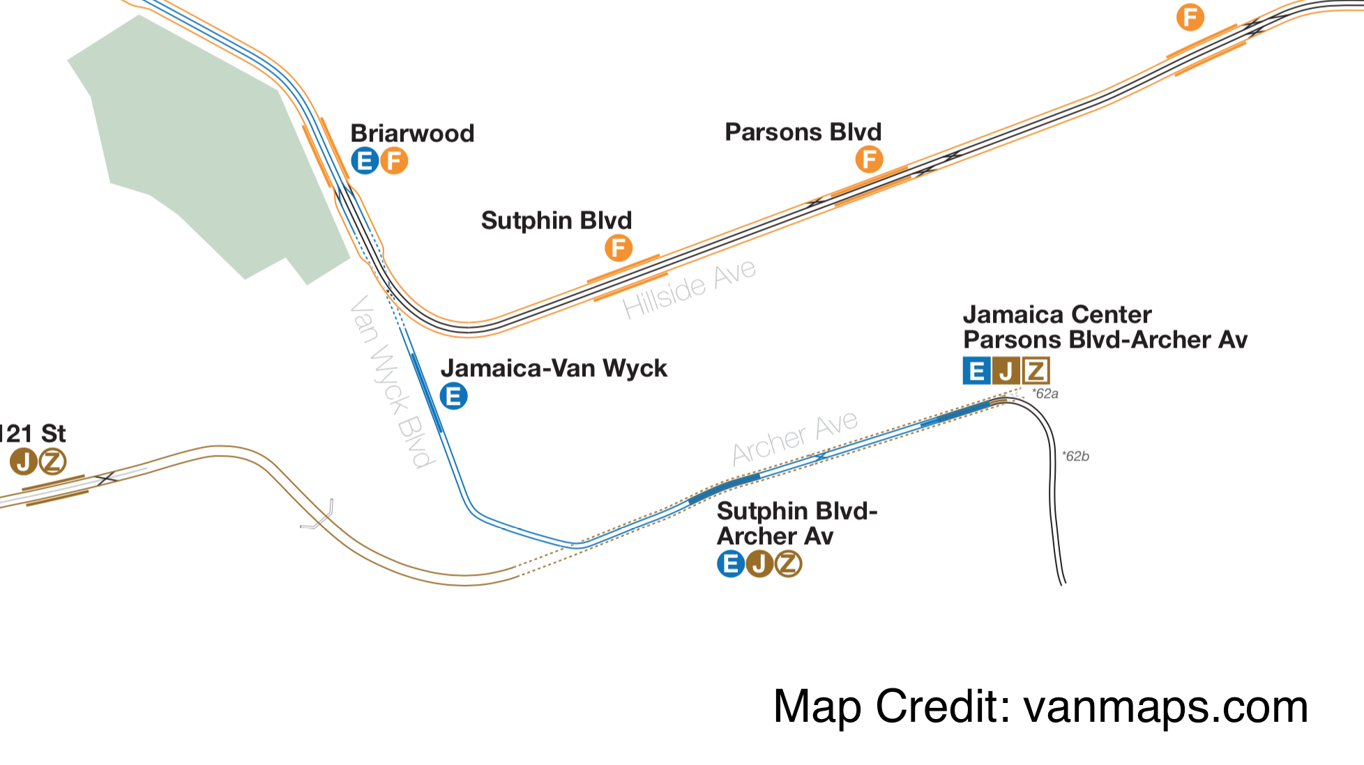
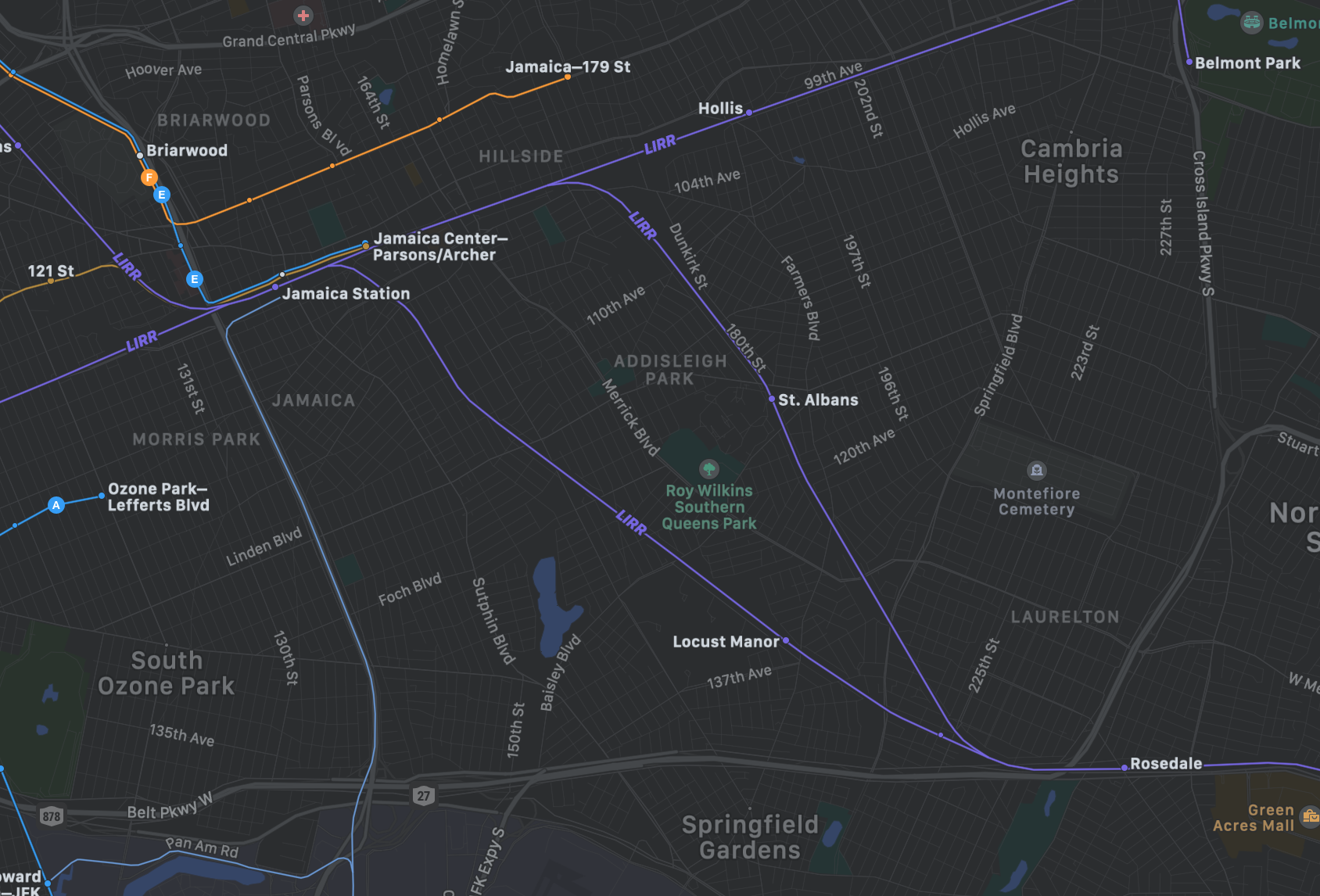
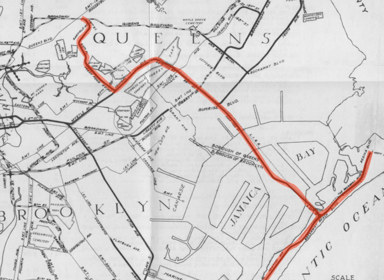
The Archer Ave Extension was built through many scandals and much political and economic turmoil as the City and TA slogged on through the ‘70s and ‘80s, a notoriously rough time for New York. The Extension brought three new stations: Jamaica—Van Wyck, Sutphin Blvd, and Parsons Blvd—Jamaica Center. It includes two levels, with the upper level for IND Queens Blvd Line trains (the E line) and the lower level for BMT Jamaica Line trains (the J and Z line). For the BMT line, it would partially replace an elevated line that had been demolished.

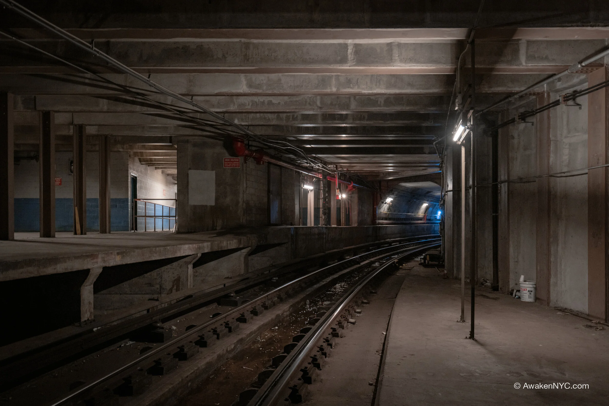
Transition point to newer ‘70s construction on branch from IND Queens Blvd Line

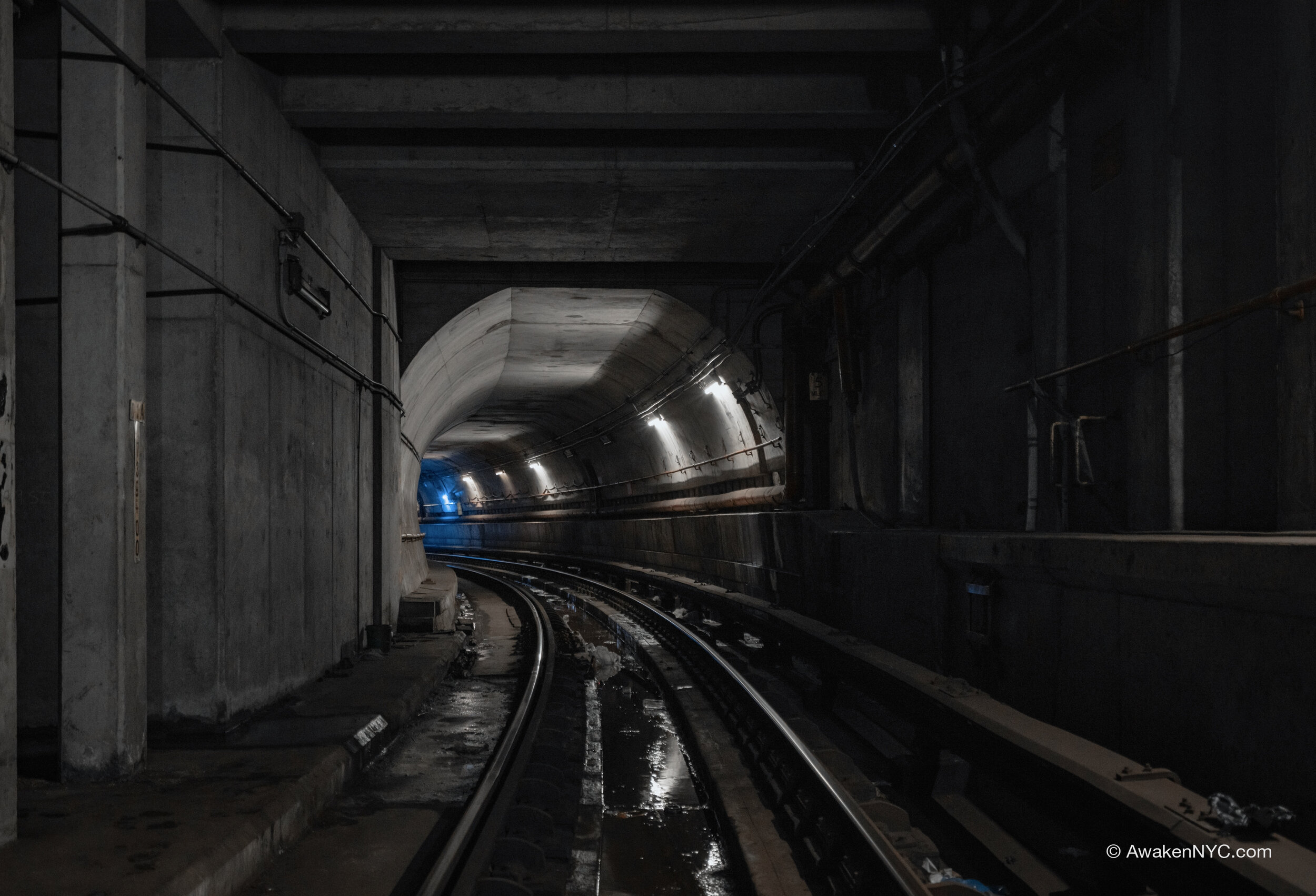
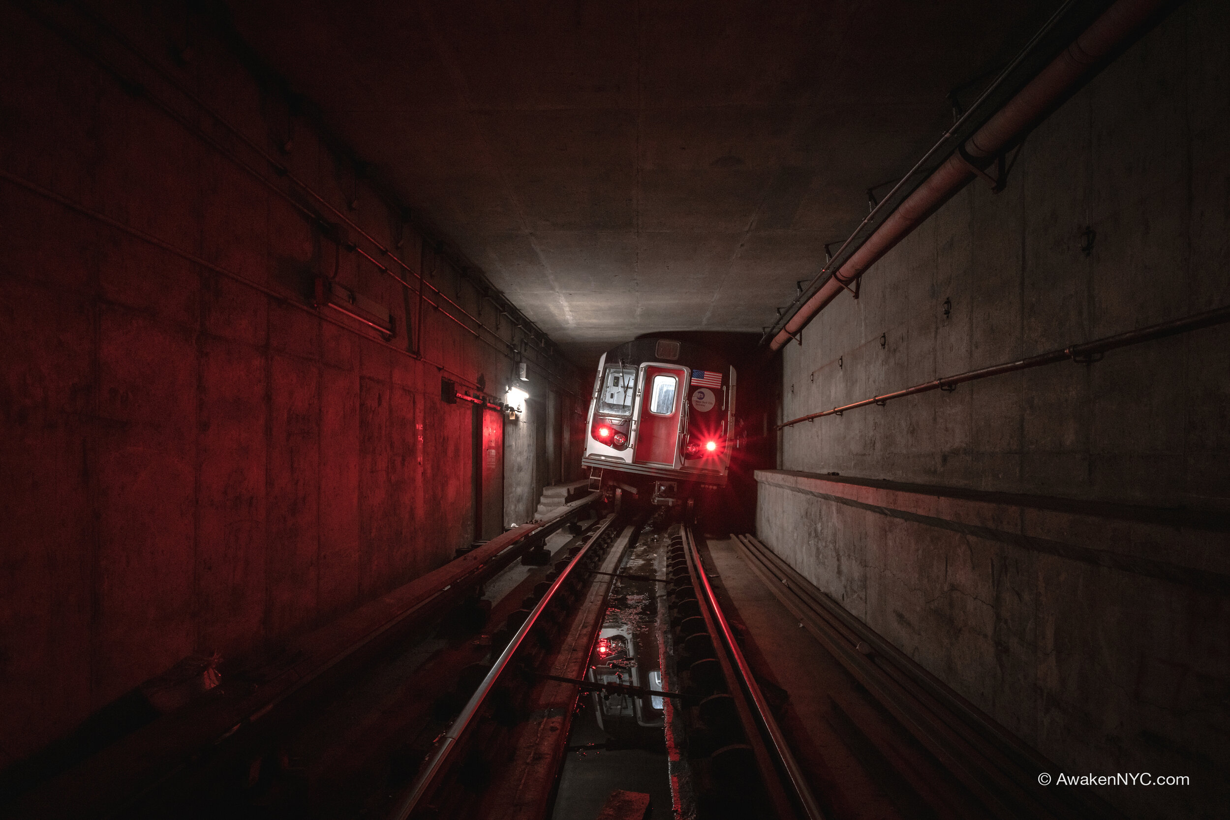
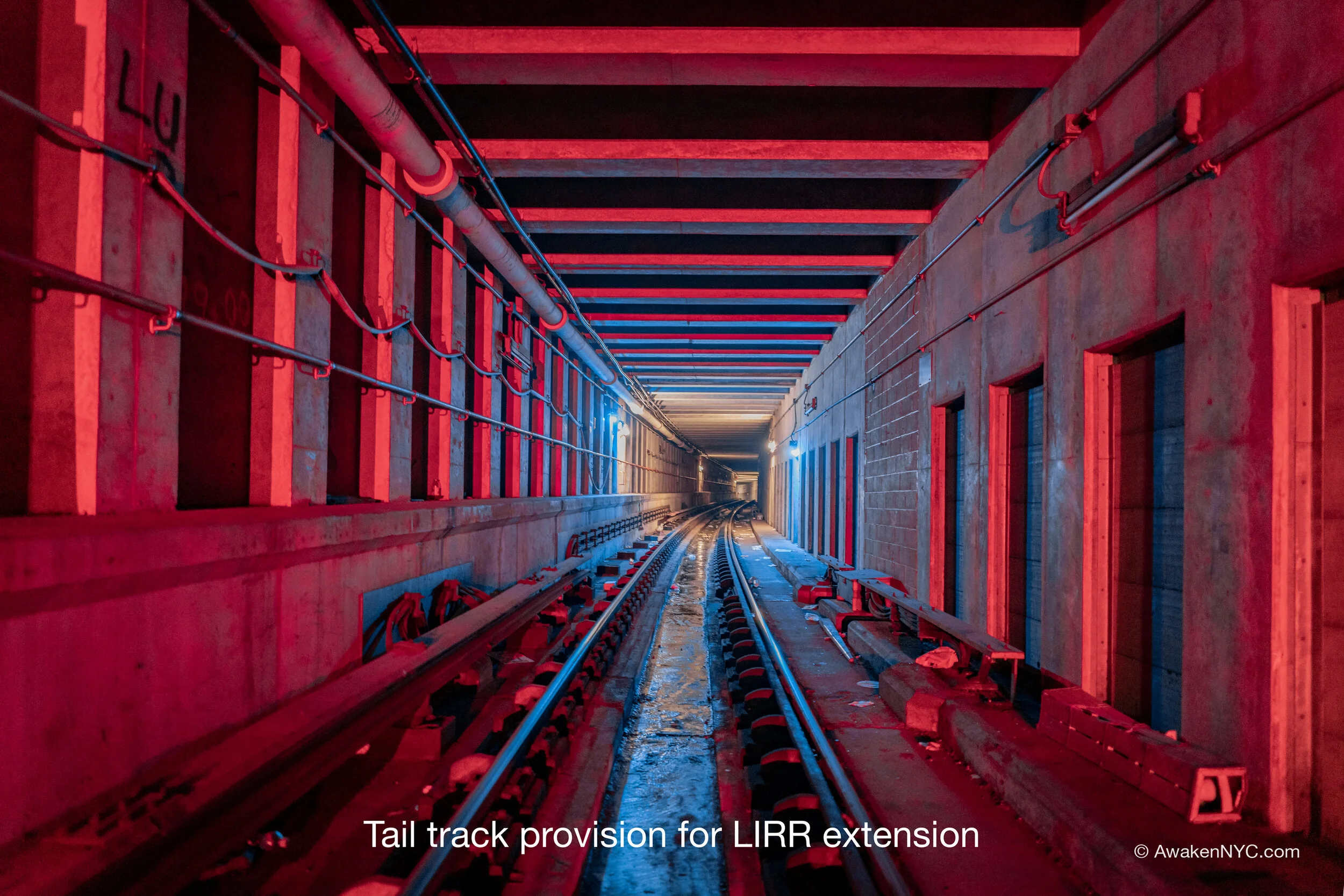
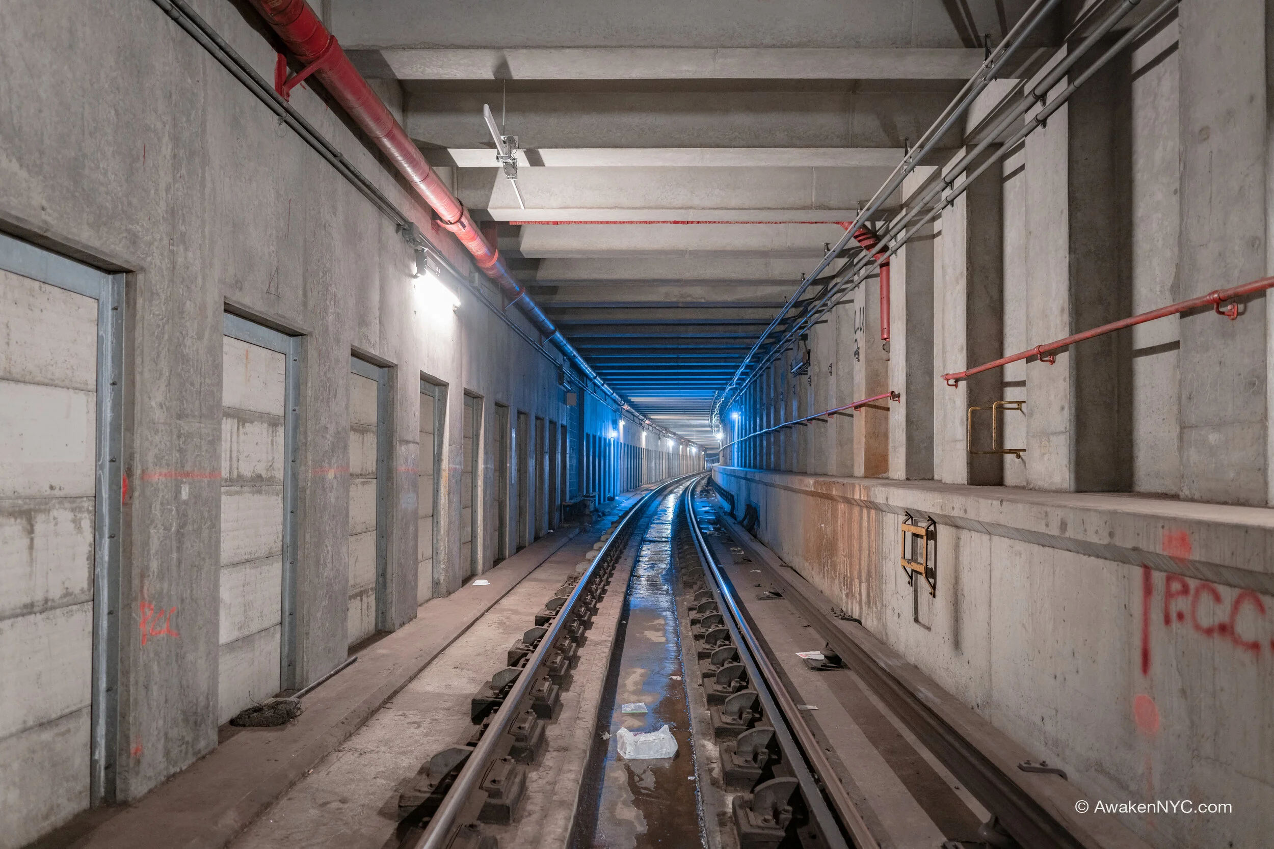
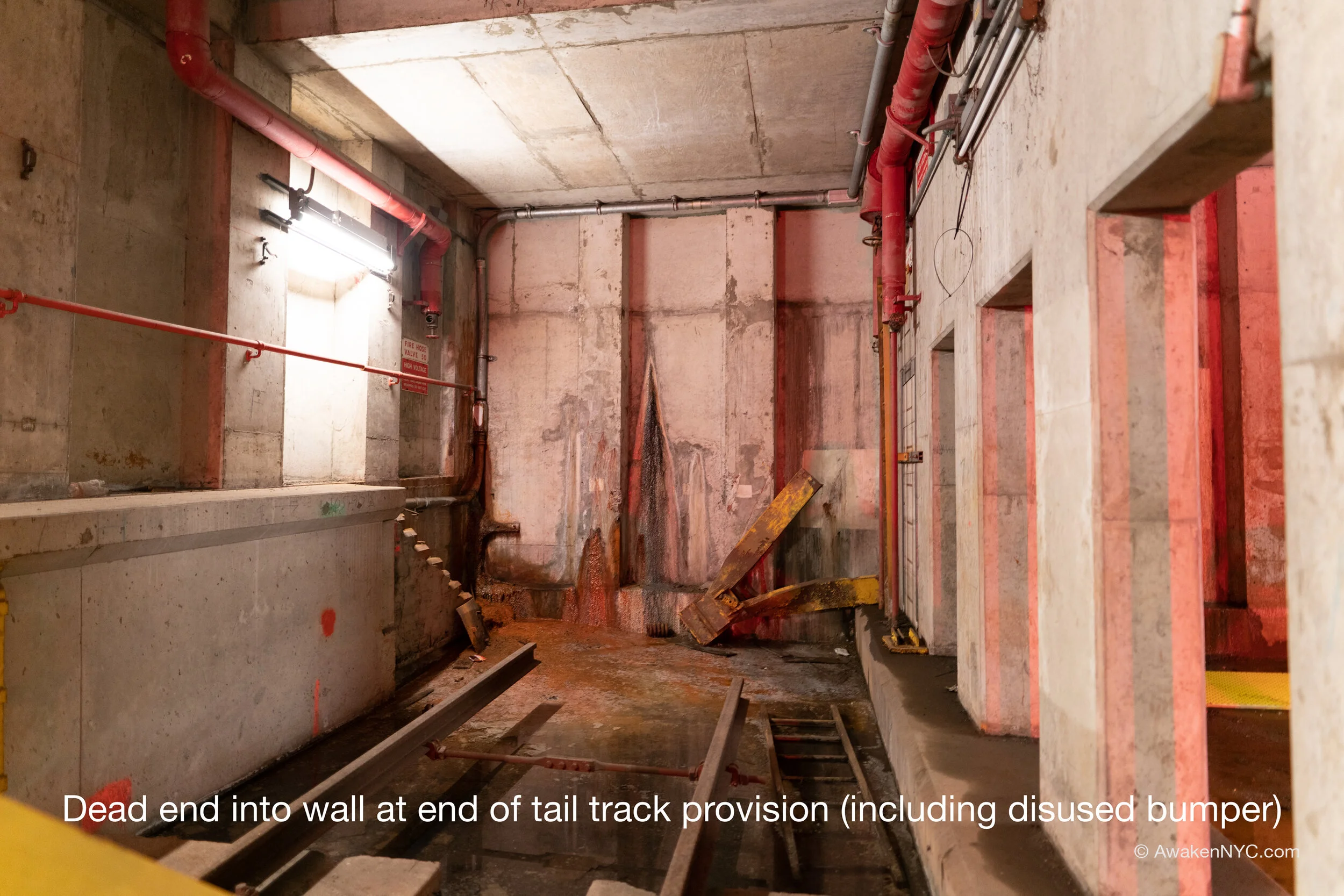
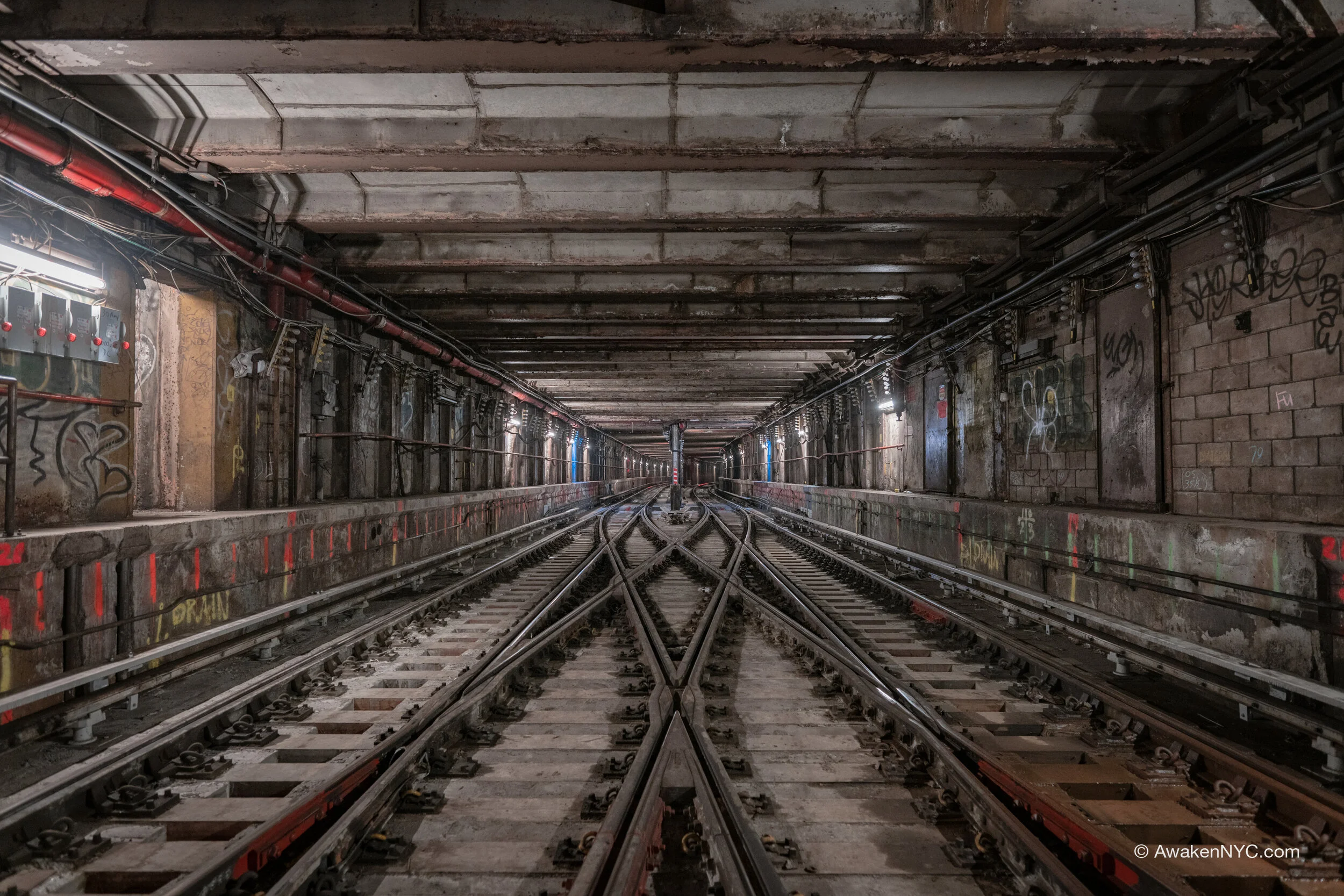
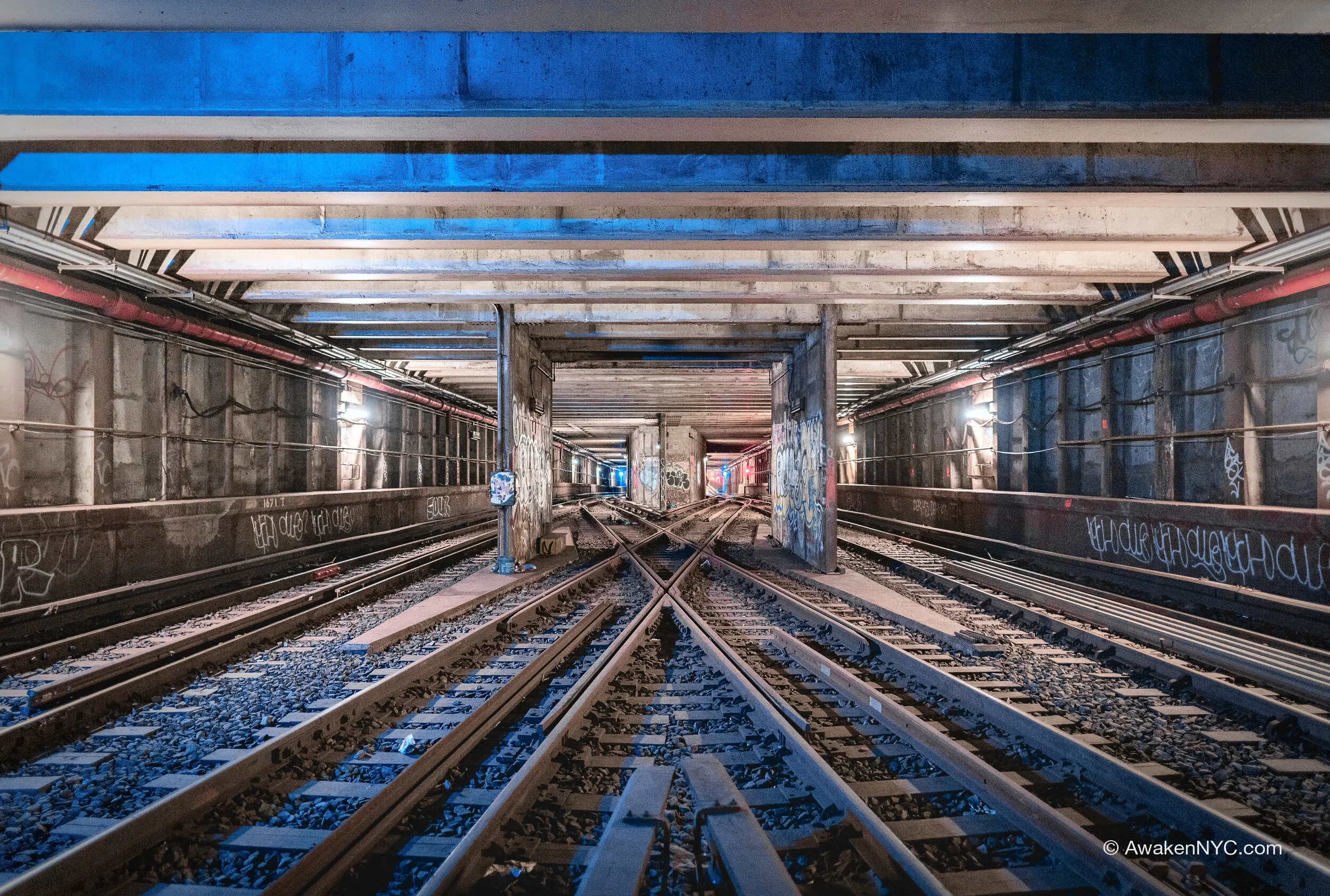
As for the IND, the line the line stemmed from a Second System provision which had been built during construction of the Queens Blvd Line in the late ‘30s, southeast (railroad north) of the Briarwood station. Originally intended for a subway extension under the Van Wyck Expressway, the provision extended as a lower level tunnel most of the way to the new Jamaica—Van Wyck station, before dead ending. The newer tunnel (constructed in the ‘70s-’80s) consists of a diamond crossover (X track) just before going into the new Van Wyck station. From there, the extension curves east to Archer Ave, becoming the upper level. The upper level continues as tail tracks after the terminal station at Parsons, curving south as a provision for a future extension down the LIRR Atlantic Branch right of way, through the now underserved southeast Queens.

The curve in the tail tracks provision, leaving many layup trains tilted

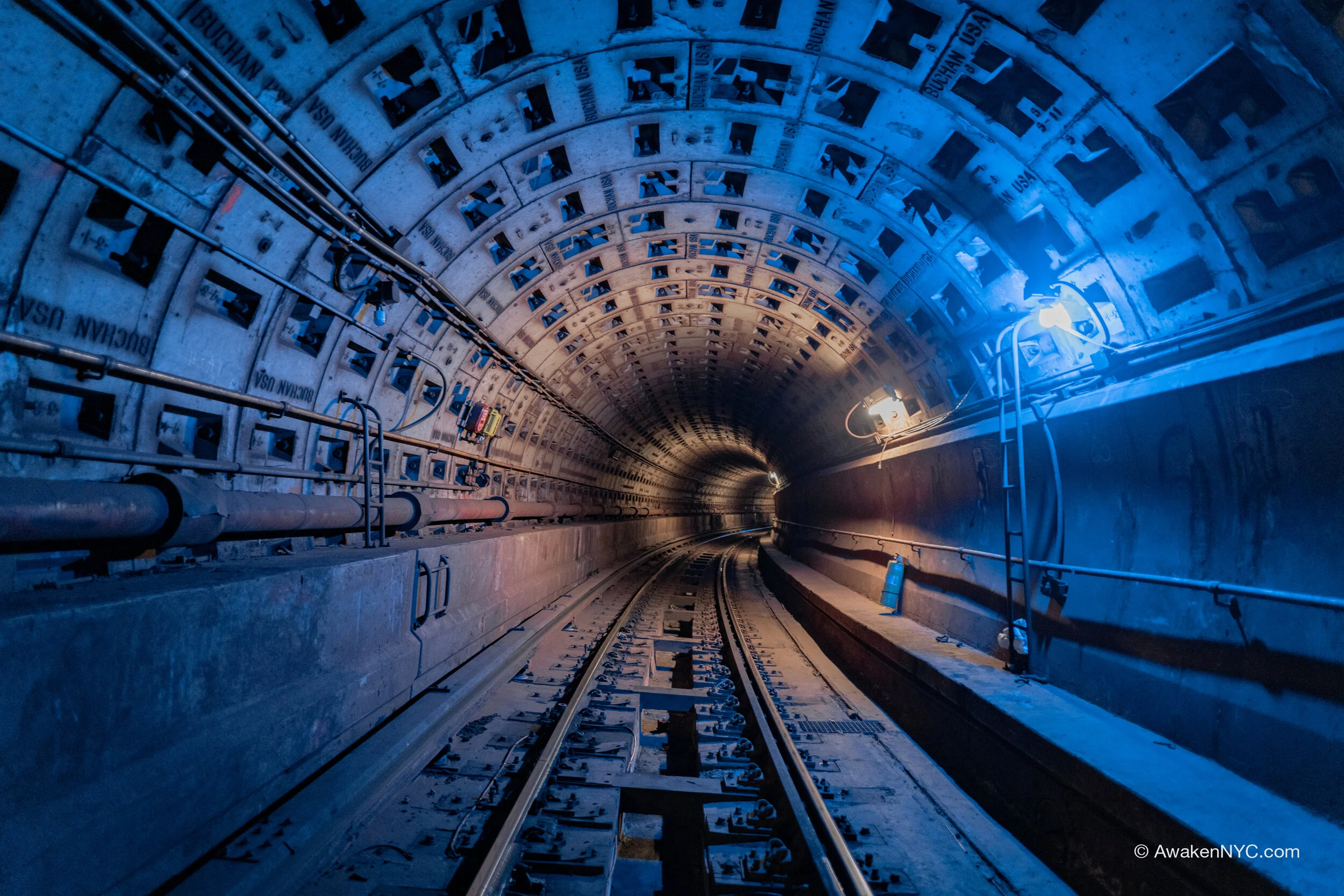
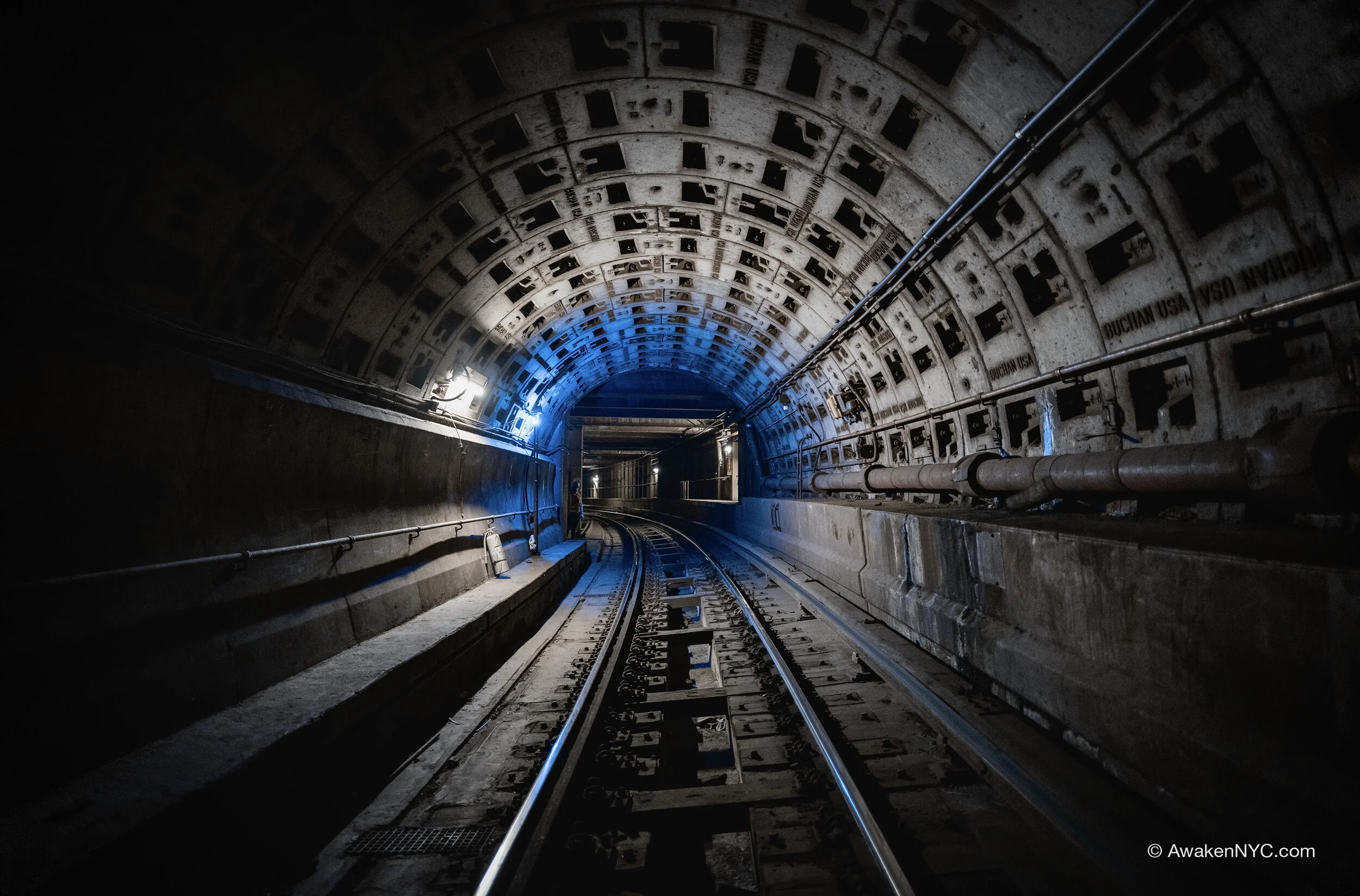
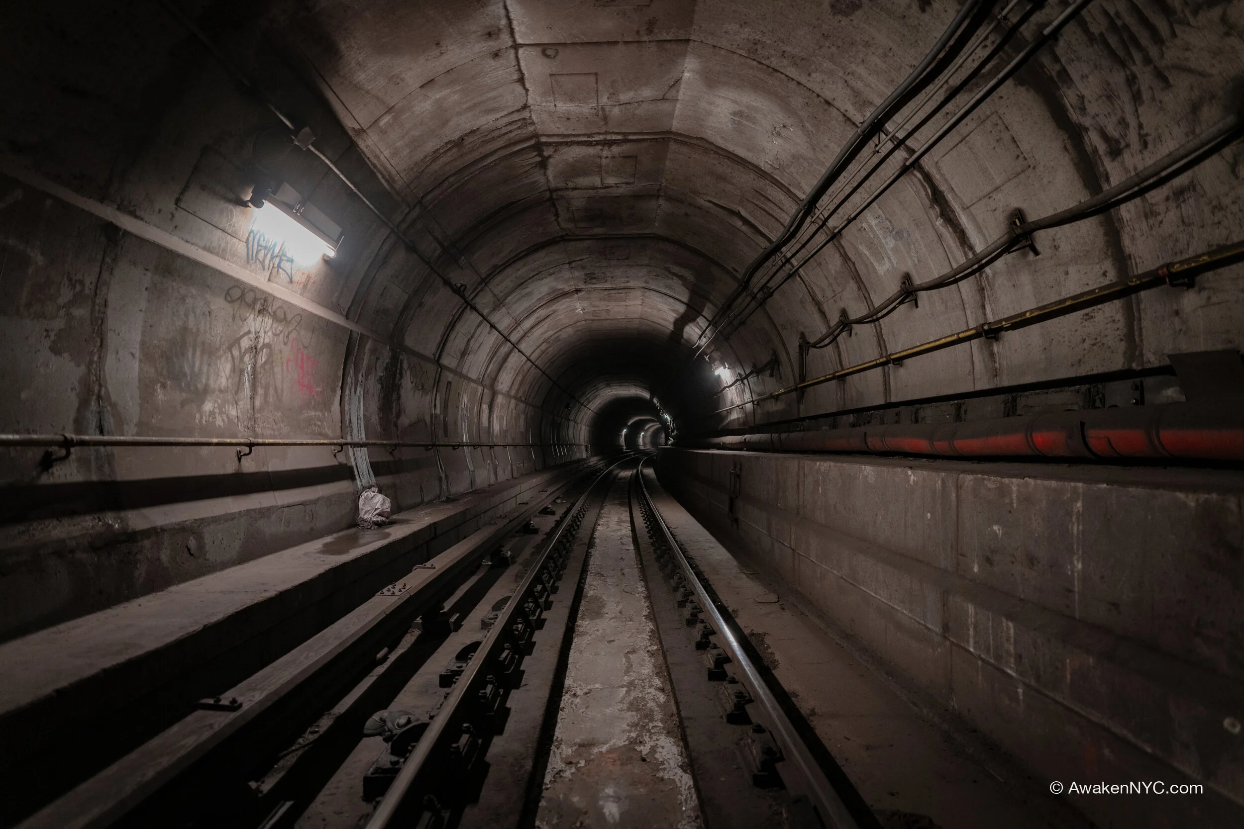
Deep bore section

The tunnels are relatively clean, as should e expected with their age, and feature different methods of construction. Some segments of the extension were constructed using the tunneling shield technique of deep bore tunneling—intended to minimize disturbance to the neighborhood. This is the source of the interesting round structure of some segments of the tunnel. However, most of the extension was built with the standard cut-and-cover method.

SSG 11: Queens Blvd Super Express (Updated)

This tunnel is a continuation of the 63rd St Tunnel, completed in 2001 to make the connection between the 63rd St Tunnel that opened in 1989 and the IND Queens Blvd Line, around 40th Rd and Northern Blvd in Long Island City. This final connection of the 63rd St Tunnel to the Queens Corridor had massive effects on service capacity in Queens.

2001 connection lead to Queens Blvd Line

Super Express line plan

The tunnel was constructed with a bellmouth provision for connection to a future Queens “Super Express” line which would run via the nearby Long Island Rail Road (LIRR) right of way. The idea for this Super Express line had actually been around for quite a while, along with the many other plans for branches/extensions under the Second System that never materialized. Under this iteration of the plan, in accordance with the 63rd St Tunnel plan, the Super Express would have gone through this bellmouth and a short distance in a new tunnel before surfacing in the Sunnyside Yard. The line then would have continue on the LIRR Main Line right of way across Queens, going express via the underutilized 5th and 6th tracks. A new tunnel would be constructed in Forest Hills to connect the Super Express back into the subway, and into the Forest Hills—71st Ave station.

The extra capacity this plan would have provided in Queens was part of a larger plan for more extensions in Queens. Trains originally would have continued onto the planned Hillside Ave extension, and in the later version would have served the new area connected to the Archer Ave Line.

Inside the bellmouth

The tunnel itself that contains the provision is rather dull, as can be observed in the photos. It’s a pretty plain gray color, though it is still relatively clean being that it’s one of the newer tunnels in the system. The provision has become a bit of a sewer, dark and full of disgusting muck. It smells awful, a phenomenon I have noticed with many similar tunnels, built near the same time and using similar construction techniques/designs. There are a few gross looking mysterious goos inside the bellmouth of off white, orange, and dark colors—likely the result of water intrusion and erosion in the concrete and steel structure of the tunnel.

SSG 10: The 63rd St Tunnel (Updated)

Under Central Park

The 63rd St Tunnel happens to be my favorite of all the tunnels. Known for years as the “tunnel to nowhere,” as well as the “Zoo York Tunnel” by artists, the 63rd St Tunnel first opened to passenger service in 1989. A massive connection for multiple lines and spanning from Midtown Manhattan to Long Island City, Queens, the 63rd St Tunnel starts at 57th St on both 6th and 7th Ave, continues north into Central Park, and curves east under the park, with the two branches coming together near 5th Ave. From there, it continues east on 63rd St, across the river (and through Roosevelt Island), and across 41st Ave in Queens, finally making its connection to the Queens Blvd Line at Northern Blvd (around 40th Rd), on the 36th St Interlocking. The tunnel contains stations at Lexington Ave—63rd St, Roosevelt Island, and 21st St—Queensbridge. There is an additional branch of the 63rd St Tunnel which begins at the Lex/63rd station, curving toward the north to meet the Second Avenue Subway. A bellmouth provision was also constructed in the tunnel between 1st and 2nd Ave to accommodate a later connection between the Second Avenue Subway south of 63rd and the Queens Blvd Line.

The 63rd St Tunnel route and track map (map credit: vanmaps.com)

63rd St Tunnel, lower level (LIRR level) in the under-river tube section

Construction on the 63rd St Tunnel began in 1969, following the MTA’s Program for Action plan for subway/rail improvements and extensions. The project would serve as a complementary project to the Chrystie St Connection and 6th Ave express tracks, both of which had been built over the prior decade and a half. Those projects introduced a higher capacity to the 6th Ave Line, as well as building a new stub terminal at 57th St and 6th Ave. The 63rd project would make use of this increased capacity and create the connection between the 57th St terminal and the Queens Blvd mainline. The plan for 63rd also called for a bi-level under-river tunnel, with the lower level being dedicated for Long Island Rail Road (LIRR) service to Grand Central (the current-day East Side Access project), while the upper level would be used by NYCT.

The reason I classify the 63rd St Tunnel as a Second System Gem is that it was the latest evolution of an earlier IND proposal for new under-river tubes at 61st St—later moved up to 76th St. The 63rd St Tunnel was also designed with several Second System lines in mind: the Second Avenue Subway (SAS) and the Queens Super Express. Half of the Manhattan portion of 63rd was unused until SAS Phase I opened in 2017, with 2 tracks and half of the Lex/63 station being unused until that point. The portion between Lex/63 and Roosevelt Island was also built with a bellmouth provision for later SAS construction, to allow a connection between SAS south of 63rd and the Queens Blvd Line.

Bellmouth provision in the 63rd St Tunnel for later connection to SAS south of 63rd

When NYC hit the fiscal crisis in the mid-’70s, the Second Avenue Subway project was called off, while the 63rd St Tunnel dragged on. A diverse set of construction methods were utilized to build this tunnel, a big part of why it is my favorite. Some sections were cut-and-cover, while others were deep bored via tunneling shield, while others were mined out via drilling and blasting, and the two under-river sections via sunken prefabricated tubes. Additionally, the tunnel was built with many features which can be observed as distinguishing hallmarks of NYC subway construction at the time: continuous welded rail, concrete roadbed and rail mounts, rubber padding on rail plates, fluorescent lighting, modern architecture, and more.

Inside of the upper level of the prefabricated under-river tubes.

The result of these different and improved methods is an architecturally diverse and pleasing tunnel, full of nooks and crannies to explore and unique angles unlike those found anywhere else in the system—even the world. This architectural diversity, labyrinth of spaces, and visually appealing design are what make the 63rd St Tunnel my favorite. Construction would continue behind schedule through budget shortfalls and logistical issues, until finally opening in 1989—two decades after construction began.

With the 1989 completion, the Lexington Ave/63rd St, Roosevelt Island, and 21st St stations were opened. However, the 21st St station in Queens served as the terminal, with the tunnel ending there. As such, the customer reach was extremely limited. To add insult to injury, more than half of the entire tunnel was unused: half of the tunnel in Manhattan had been built as a provision for Second Avenue Subway service which didn’t exist, and half of the tunnel in Queens and between Queens and Manhattan was intended for LIRR service to Grand Central, which also didn’t exist. The connection to the Queens Blvd Line was finally completed in 2001, 32 years after construction initiated.

The connection to SAS was not completed until 16 years later, on Jan 1st, 2017. For photos of the tunnel prior to and during SAS construction, check out the LTV Squad website, with an article from when the tunnel was dormant, and an update from mid-construction, as well as this one showing the SAS tracks prior to the project. Today, the 63rd St Tunnel serves Q trains to/from Broadway and 2nd Ave, as well as F trains to/from Queens Blvd and 6th Ave. Construction on the LIRR East Side Access project is also nearly complete, after years of delays, controversy, and budget gouging (I will do a mega-post on the ESA project once it is complete).

SSG 9: The Chrystie St Connection (Updated)

In the earlier days of the subway, the BRT (Brooklyn Rapid Transit Company—later the BMT, Brooklyn-Manhattan Transit Corporation) claimed the Manhattan Bridge as its own, creating a major link between the extensive BMT lines in Brooklyn and their lines in Manhattan. The Manhattan Bridge was built with two sets of tracks, with a pair on either side of the bridge (under the side roadways and next to the pedestrian/bike paths). As originally configured, the northern set of tracks connected to the BMT Broadway Line (today’s N, R, R, and W lines), while the southern set connected to the Nassau St Line (today’s J and Z lines).

However, by the ‘60s, any value in the connection to the Nassau loop via the Manhattan Bridge had been lost, and the NYC Transit Authority (TA)—which had absorbed control of all three rapid transit corporations in the city by the ‘40s—decided to sever the connection and reconfigure the tracks such that the southern set would link to the Broadway Line, while the northern set would link to the IND 6th Ave Line (today’s B, D, F, and M lines) via a new tunnel under Chrystie St on the Lower East Side. The project would accordingly be dubbed the “Chrystie St Connection,” and would reshape the entire transit system for good.

Chrystie St Connection details

Chrystie St Connection details

The plan for the new tunnels would provide for a connection between the Nassau St Line and 6th Ave Line and between the BMT lines in Brooklyn and the IND 6th Ave Line. The connection would begin east of the IND Broadway—Lafayette station, with the express tracks sloping upward and going over their former connection to the 2nd Ave station. Additionally, there would be a new flying junction on the local tracks. The tunnel would then curve south on Chrystie St, with the local tracks turning back east on Delancey St, making a connection with the Nassau St Line between the Essex St and Bowery stations, allowing 6th Ave local trains (today’s M line) to connect to the BMT Jamaica Line via the Williamsburg Bridge. The express tracks would continue further south on Chrystie St, continuing south to the Manhattan Bridge. A station would also be constructed at Grand St for trains on the express tracks (today’s B and D lines).

It was decided to utilize the cut-and-cover tunnel construction method for the Chrystie project, and as such, Chrystie St was almost entirely torn up. Urban legend has it that with this tunnel, a provision was built for LoMEx: the Lower Manhattan Expressway. LoMEx was a Robert Moses project, the idea being reducing the high vehicular congestion in the neighborhood, especially that due to traffic going between the West Side Highway, the Williamsburg Bridge, and the Manhattan Bridge, and the project was planned to run under Chrystie St for the lead up to the Manhattan Bridge. While I haven’t heard accounts of people getting in or seen photos, and haven’t seen it with my own eyes, I wouldn’t doubt that some provision could have been constructed. For some time, many people believed the provision was under a mysterious stairway concealed by a grate in the middle of the tunnel, but this sealed up stairway actually goes down to the Bowery station of the BMT Nassau St Line, over which the Chrystie tunnel directly passes.

While the connection, which opened in 1968, is relatively small, its effects were enormous. The extensive BMT lines in Brooklyn were now able to carry trains to/from IND lines in Manhattan, creating greater connectivity for the city. Prior to the connection, despite unification of the three companies into one system in the ‘40s, New Yorkers regularly distinguished lines by the company names still—the IRT, BMT, and IND. Suddenly, the BMT and IND were intertwined. The Connection also began to utilize the new capacity created on 6th Ave by the express tracks and 57th St terminal. Soon, following the opening of Chrystie, came the 63rd St Tunnel project to take greater advantage of that capacity, extending past 57th St.

SSG 6: The Rego Park Provision (Updated)

Another prominent provision along the IND Queens Blvd Line—though lesser known than the Winfield Spur at Roosevelt Ave—the Rego Park provision was planned to serve a very similar route to the Winfield Spur. Sitting between 63rd Dr and 67th Ave are several bellmouths to provide for an extension south via the LIRR Rockaway Beach Branch right of way, without having to reconstruct the entire surrounding tunnel on QBL (similar to other Second System provisions around the city). It’s unclear to me what exactly the progression of plans for this branch of the line was, but in 1929 only an extension branching from Roosevelt Ave had been planned, and by 1939 the extension was only planned to go from this provision.

Southern bellmouth between 63rd Dr and 67th Ave, QBL

Regardless, this line would have brought full time subway service to underserved or unserved neighborhoods and made use of the now decaying LIRR Rockaway Beach Branch (a land of many mosquitoes). Recently, there have been several proposals to utilize this line, but unfortunately, none have gained any traction.

North bellmouth near 63rd Dr

There isn’t much to the tunnel itself at a glance: the provisions are in a standard IND tunnel, cut and cover (boxy) construction, between two local stations. However, a nearby local station, Woodhaven Blvd, actually would have been converted into an express stop during the construction of this line. Furthermore, an additional under-river tunnel between Queens and Manhattan was proposed to supplement service to this line. Originally, the under-river tunnel was planned to be at 61st St, but by 1939 it was moved to 76th St, to join the Queens Blvd Line at Broadway and Steinway St in Queens. This under-river tunnel did actually later materialize as the 63rd St Tunnel.

SSG 20: The Conclusion

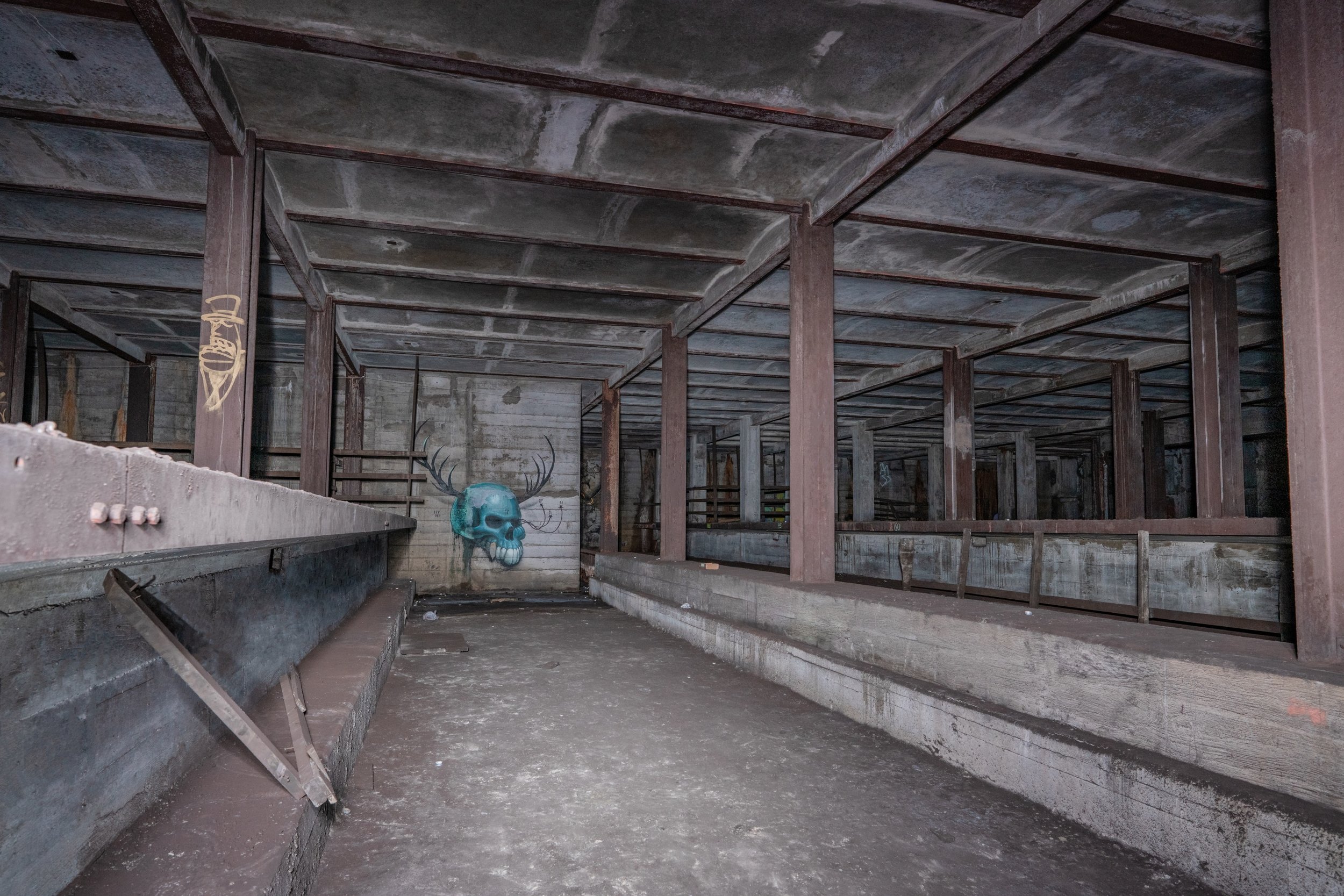
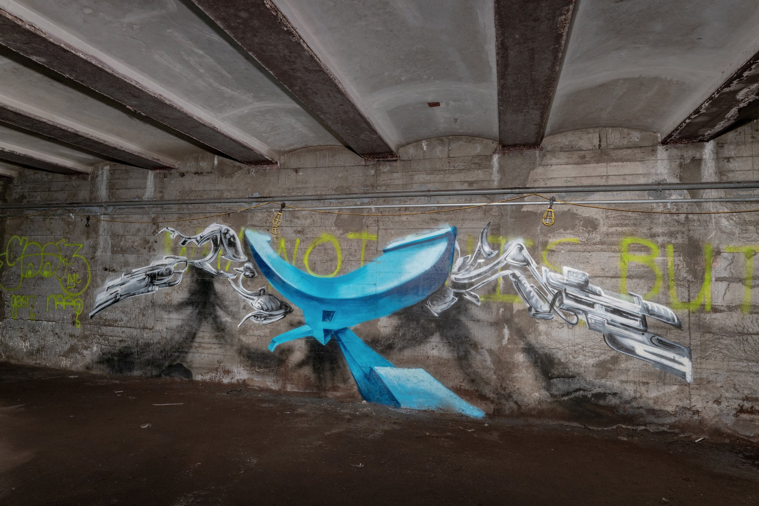
To start off, I really enjoy doing these longer “series” posts, and will continue this style of posting. I didn’t really know where I was going with this when I posted the first Second System Gem (S 4th St aka Underbelly), but I like how it turned out. Below, I am showing photos of some honorable mentions and my favorites from the series.

This series covered every provision that I know of in the existing system that was included in the IND Second System plans of the late 1920s and the 1930s. The Second System would have doubled the size of the NYC Subway, serving transit-desert neighborhoods and feeding the capacity of the First System.

The major lines of the Second System plans that I covered were the 2nd Ave line, 63rd St line and Boston Road line; the Lafayette Ave line; Worth St, S 4th St, Utica Ave, and Myrtle Ave lines; the Pitkin Ave line; the World’s Fair line, Queens Blvd super-express and Rockaway lines, Archer Ave/Rockaway line, and Hillside Ave line.

1939 IND Second System plan (including existing track)

One such provision in the 63rd St tunnel, sometimes called a “bellmouth”

Almost the entire Second System plan was abandoned, so “provisions” (for easy extensions of lines) that were built in anticipation of the Second System construction sit throughout the IND system collecting dust. Most of the plans of the Second System were dropped during the Great Depression, and they never regained momentum due to World War II (shortage of labor and funds), the Robert Moses era (focus shifted from trains to cars), and the White Flight of the 50s and 60s (people left the city and took their money with them). However, some plans were preserved and constructed, or are in progress.

In the 60s, the Chrystie St connection was constructed, which expanded the capacity of the 6th Ave line, and connected it to the BMT in Brooklyn. It opened in 1967, and in 1968, the Program for Action was proposed, which set in motion the construction of the 63rd St tunnel, 2nd Avenue Subway (SAS), and Archer Ave extension, with the 63rd St tunnel/Chrystie St connection utilizing the additional capacity to feed the QBL (Queens Blvd Line).

As the ‘70s rolled around, the Transit Authority (TA) was ready to finally begin construction on the 63rd St tunnel, Second Avenue Subway, and Archer Ave extension. Ground was broken for the 63rd St tunnel in late 1969, in Queensbridge Park. In 1972, ground was broken for SAS, and soon thereafter in 1973, ground was broken for the Archer Ave extension.

Completed SAS segment from the ‘70s

Unfortunately, things soon took a turn for the worse. When the fiscal crisis hit the city in early 1975, the timeline for every line was pushed back. A stop work order was issued for one section of SAS being constructed (from 2nd St-9th St), and the other three portions that had been completed were sealed (Chatham Sq-Canal St, 99th-105th St, and 110th-120th St). Construction on the 63rd St tunnel and the Archer Ave extension continued, but the projects were delayed significantly due to the city’s financial constraints.

Finally, in 1988, the Archer Ave extension opened after being plagued with problems and delays for years. The 63rd St tunnel opened soon after, in 1989. However, more than half of the 63rd St tunnel would go unused for decades, and the capacity of the F line T1/2 tunnel was not fully utilized until the connection between 21st St—Queensbridge and the Queens Blvd Line at Northern Blvd was completed in 2001. (The capacity of the G3/4 tunnel was not utilized until SAS Phase I was completed in 2016.)

7 extension south of 34th St

In 2002, plans were submitted by the MTA for an LIRR connection to Grand Central—East Side Access—utilizing the lower level of the 63rd St tunnel as originally planned. In 2004, the MTA submitted a large proposal for a full length SAS completed in four phases. Then, in 2005, a proposal was submitted for an extension of the 7 line to 34th St—Hudson Yards as a part of the proposal for the development of Hell’s Kitchen in the area around the LIRR West Side Yard. These projects are the only significant expansion projects that have been proposed and gained traction in the past 30 years—and they probably will continue to be the only ones. Expansion projects in the 21st century follow the money. The 7 extension was only built because NYC wanted to host the 2012 Summer Olympics, and because billionaire developers wanted to build a massive project in the area. The Second System plans other than SAS all serve neighborhoods with no major redevelopment plans, so they will probably not be revived anytime soon.

Construction on SAS Phase I and East Side Access started soon after the approval, and SAS Phase I was completed at the end of 2016. East Side Access is near complete as of the time I’m writing this, and is projected to open in 2022. SAS Phase II is but a possibility at this point (until the money comes in) and I can’t imagine Phases III-IV happening anytime in the next 50 years. I dare the NY government to prove me wrong :)

SSG 19: SAS--To Phase II, and Beyond

My previous Second System Gems post gave some history on the Second Avenue Subway (SAS)—one of the most notable IND Second System plans—focusing on the plans and construction progress of the twentieth century. This post will focus on the more recent progress on the line (Phase I, completed in 2016, and the subsequent planned phases).

Proposed SAS route after all phases are complete

Proposed SAS route after all phases are complete

At the turn of the millennium, it had been over 70 years since SAS had first been planned. The plans had been set aside for decades due to a lack of funds for capital projects, but pressure from the public finally started to have an effect. By 2001, preliminary plans were drawn for a full length SAS, to be built in four phases. Phase I, to be completed in 2012, would begin at Lexington Av-63rd St, utilizing the unused half of that station and the 63rd St tunnel (which was built with SAS in mind) to feed SAS. It would then turn north up 2nd Ave, with new stations at 72nd, 86th, and 96th St. The tracks would continue north of 96th St to around 104th St, connecting to one of the ‘70s era tunnels, which had been constructed between 99th and 105th St. These tail tracks allow for a greater line capacity and will allow for a more fluid service transition when Phase II is completed.

Construction on Phase I began in 2007, with a new estimated completion date of 2013. The subway was constructed as a deep bore tunnel with a Tunnel Boring Machine (TBM), and mining techniques to minimize surface disruption (except at the 96th St station, where cut-and-cover was used). Various contractors were hired to construct the line (notably Schiavone Construction, Skanska USA Civil, and J.F. Shea Construction) many of whom ran into trouble at points during the construction. Progress ran far behind schedule, with the completion date pushed back to 2016. The line finally opened on January 1st, 2017 in a grand New Years celebration with Gov. Cuomo in attendance.

The connection point on S2 track between the 2000s era SAS tunnel and ‘70s 99th-105th St segment (notice the change in construction style), looking south towards 96th St

Bumper block at the north end of the layup on S1 track

North of 96th St, the Phase I tunnel connects to the segment of tunnel between 99th and 105th St in the early ‘70s. Tail tracks extend north of the station, currently used to store trains at night and on the weekend. When Phase II eventually opens, these tracks will continue up to 125th St. In the meantime, bumper blocks were installed on the tail tracks at approximately 104th St, and a cinderblock wall was constructed just north of the bumpers. Behind the wall, the tunnel continues for another block or so, looking largely the same as the layup tunnel, but without tracks on the roadbed. There is a pump room/electrical facility in a hallway off to the side at 105th St.

Provisional cavern for Phase III extension on G4 track south of 72nd St

Construction on Phase II was originally scheduled to start in 2020, with preliminary studies already nearly complete. The line will be extended north, with stations at 106th/2nd Ave, 116th/2nd Ave, and 125th St between Lexington and Park Ave. In the more distant future, Phase III is supposed to extend the line south, from 63rd St to Houston St, and Phase IV is supposed to complete the line south of Houston, with a terminus at Hanover Sq. South of 72nd St, caverns were constructed containing provisions to allow for a relatively easy connection to Phase III, whenever it may be constructed. Provisions were also built in the 63rd St tunnel, to allow for northbound SAS trains to turn east at 63rd St and head to Queens, and to allow southbound QBL trains to turn south down 2nd Ave (as opposed to continuing across 63rd St to 6th Ave).

The Covid-19 Pandemic has delayed Phase II “indefinitely,” pending the acquisition of capital funds to finance construction. Should the money come in (from the Feds) construction likely would commence.

SSG 18: 2nd Ave Subway Relics of the '70s

The Second Avenue Subway (SAS) is one of the most prolific plans of the IND Second System, and one of the most notorious proposed subway lines in New York City. For nearly a century, before the 2nd Ave Elevated was even demolished, New Yorkers have been promised a full length SAS. The history of SAS serves as a great summary of the IND Second System plans overall: big plans, small budget. This post will focus on the initial attempt at construction of SAS, and the next will focus on the recent construction.

In the 1929 Second System plan, the city proposed an enormous full length 2nd Ave line, starting in lower Manhattan (connected to a new line in Brooklyn via a new under-river tunnel), and running up north to the Bronx (through another new under-river tunnel). This line would have a greater capacity than any other line ever built before it, with 4 tracks for most of the line, and 6 tracks on the portion from 61st St to 125th St. SAS was put on hold when the Great Depression hit, and the plans didn’t gain enough momentum for revival until after the predecessor to the MTA—the Board of Transit, and later the Transit Authority (TA)—was formed.

The 99th-105th St segment originally constructed in the ‘70s and later connected to Phase I; looking south towards 96th St

The 60s marked a new era for the TA with the construction of the Chrystie St Connection, and in 1968 came the Program for Action. This provided for the construction of SAS and the 63rd St tunnel, which was interwoven with the SAS plans. Finally, in the early ’70s, SAS construction commenced. Ground was broken for the first segment in October 1972, and a few other segments soon followed. Three of these segments were completed: 99th-105th St, 110th-120th St, and Canal St-Chatham Sq, and they lie dormant to this day. These tunnels are lit 24/7 and actively maintained by MTA NYCT. They serve as a somewhat spooky reminder of the ambitious NYC infrastructure plans from long ago. When the fiscal crisis of 1975 hit, construction on SAS was halted indefinitely. The other projects of the time, the 63rd St tunnel and the Jamaica Extension, were completed, though not in a timely manner.

The former 2 of the completed segments will play key roles in the current Phase II construction of SAS, which is slated to start as soon as the money comes in. It might take a while.

SSG 17: The Bronx Provision

The Bronx, in terms of rapid transit service, is traditionally seen as IRT territory. The IND only built a single line (with just 3 tracks) in the Bronx, under Grand Concourse—a line which is parallel with the IRT Jerome Av line and is just 2-4 blocks east of it. This line is now serviced by the B and D trains, with D trains running all times to 205th St, and B trains running on peak to Bedford Park Blvd—the second to last stop. Off peak, B trains terminate at 145th St, and the B doesn’t run during late nights or weekends. This makes the Concourse line a rather lonely one. While the IND didn’t have huge plans for the Bronx, the Second System did provide for a significant extension of the Concourse line and construction of a line (with a couple branches) in the eastern Bronx, as the northern segment of the Second Avenue Subway (a lot more on this in the next installment of this series).

Bumper block at the east end of the 205th St tail tracks

There is but one IND Second System provision that was constructed in the Bronx. The northern terminus of the Concourse line, at E 205th St in Norwood, has possibly the strangest track layout of any IND terminal station. It has tail tracks, but these are kept clear to be used as relay tracks (serving to turn trains around). There is no crossover between the northbound and southbound revenue tracks between Bedford Park Blvd and 205th St, so all revenue trains must pull into the station on what would be the northbound track, discharge passengers, move forward into the relay, and then reverse back onto the southbound track (trains may switch tracks when pulling into the relay, or when pulling out after reversing). Trains may also come into 205th St directly from the Concourse Yard on a middle track west of the station (railroad south), going directly into service at 205th St.

Track layout of Bedford Park Blvd, Concourse Yard, and 205th St area

The reason for the odd track layout of this area is simple: 205th St was not intended to be the permanent terminus of the line. The Second System plans called for the line to be extended to Boston Road and Baychester Av, next to the present day site of Co-Op City. This extension would have improved the commute of many Bronx residents, eliminating much reliability on slow bus routes.

SSG 16: Secrets of the G Line

The IND Crosstown line, better known as the G line, is often characterized as a lonely, underutilized line. The reality is that it is a relic of a different New York. It is a line that was supposed to have been interwoven with other lines (planned for the IND Second System) branching through Manhattan, Brooklyn, and Queens, the plans for which never came to fruition.

As with nearly every single subway line built by the IND, the Crosstown line was built with a number of provisions for future expansion, in order to provide for easier connections to the planned lines. These include provisions for a Lafeyette Av line, Myrtle Av line to the Rockaways, and a Stuyvesant Av to Utica Av line. The latter two lines would have run through the S 4th St hub (better known as Underbelly), a station shell provision for which was built above the Broadway station.

Provision past Bedford-Nostrand Avs

The Lafayette Av line would have run from Manhattan (possibly as an extension of the planned 2nd Av line) via new crossriver tunnel, connecting to the G at or about Hoyt/Schermerhorn Sts and running up the Lafayette Av portion of the line. Past Bedford/Nostrand Avs where the current Crosstown line curves North onto Marcy Av, the Lafayette Av line would have continued East. Provisions for this extension were built at Classon Av and Bedford/Nostrand Avs, with a space for a middle track built at Classon Av (intended for layups/storage for short runs), and 2 tail tracks East of Bedford/Nostrand Avs. These tail tracks sink beneath the Crosstown line and head a short distance east before dead ending at bumpers.

Bedford-Nostrand Avs middle track

Classon Av provision

Three of these four provisions can be seen simply by standing on station platforms. The ones at Classon Av and Bedford/Nostrand Avs are pretty straightforward. The tail tracks east of Bedford/Nostrand are dark, damp, and dirty, as is the S 4th St station shell. Today, the middle track and tail tracks at Bedford/Nostrand are occasionally used for short term train storage, especially for garbage collection and other work trains.

SSG 15: Underbelly 2 - Utica Av Upper

S 4th St station shell, AKA “The Underbelly Project”

As we move deeper into the IND Second System plans, it becomes apparent that the IND had big ideas for Brooklyn. One of these plans remains relevant to this day: the Utica Av line. Recently, the MTA began reviewing the feasibility of a Utica Av line as an extension of the IRT Eastern Parkway line (the 3 and 4). A subway going under Utica Av would serve an area which lacks good rapid transit option extremely well. The IND knew this even in the 1929 plan, and they planned accordingly. Several provisions were constructed to allow for other lines to feed into Utica Av, including provisions for the Worth St line, a new crossriver tunnel, and two station shells. The first station shell, built above the Broadway (G) station, was for the S 4th St station, now better known as “Underbelly,” due to the underground art installation titled the Underbelly Project.

The Utica Ave upper level provision

This post is about the second of the two station shells, which was constructed at the Utica Ave station on the Fulton St line (the A and C). The station would have likely been renamed Fulton St—Utica Av upon completion of the Utica Av line, had it ever been built. Furthermore, the Utica Av station contains an enormous full length intermediate level mezzanine, now used as a storage and utility area.

Closed Utica Ave mezzanine

The station shell itself is very dark and extremely hot and humid. There is barely any ventilation within the shell. It is somewhat dusty, though it is not nearly as bad as the “brown snow” in S 4th St. Completely unlike S 4th St, this spot has managed to remain clean for over 80 years, feeling like a sliver of untouched history in a system that has shown rather obvious signs of its age in recent years.

SSG 14: East New York Provision

One of the lesser known IND Second System provisions also happens to be one of the smallest—what a surprise! Today, we are looking at another provision on the IND Fulton St line, now the A and C in Brooklyn. This one was to allow trains to continue to a proposed subway under Jamaica Av. The IND seemingly had the goal of undermining the BMT Jamaica El with this nearly parallel subway line. It’s unclear what the plan was once the Jamaica subway would reach Crescent St/Jamaica Av, where the Cypress Hills station for the BMT Jamaica Elevated stands. The intention of the IND was likely either to recapture the el and send IND trains up ranps onto the elevated line, or to undermine the el with a full length Jamaica Av subway, and tear down the elevated line upon completion. It figures that the plans for this line never really took off, as this route was and is covered by the Jamaica Elevated, now the J and Z lines. When the city was low on funds, these plans would be one of the first to be scrapped.

Provisional space on the left

The tunnel itself, like many tunnels on the Fulton St line has some pretty historical graffiti, with some of the greats near the provision. Besides that, it is a pretty standard late IND-era tunnel, with lots of thick concrete columns and the prolific cut and cover “box tunnel” look.

SSG 13: Grant Layup, Pitkin Yard Leads, and 76th St

Moving back into Brooklyn, we come to one of the most famous IND Second System provisions, matched only by S 4th St (Underbelly) in terms of notoriety. This provision is commonly known as the 76th St Provision, Grant Layup, or Pitkin Yard leads. A popular spot for explorers and graffiti writers (indeed, there is much notable historic graffiti inside), this spot rose to fame do to 50+ year old urban legend. Legend has it that the walls behind the bumper blocks on the lower level and the cinder block wall branching from the yard leads on the upper level are actually hollow, with a full set of tracks and a 76th St station shortly past.

Cinder block wall provision

So, why was this provision built in the first place? The IND originally intended to continue the Fulton St Line (which the A and C run on in Brooklyn) east into Queens down Pitkin Av and Linden Blvd, all the way to 229th St near the city limits. This extension would have served a large transportation desert, which now only has buses and the LIRR as options for rapid transit. To continue to this line, trains would have run through the lower level tunnel (Grant Layup, which isn’t much of a layup anymore) past where the wall and bumpers are. Trains also would have directly accessed the line from Pitkin Yard, which is why the upper level provision with the cinder block wall was built.

Concrete wall in lower level layup

Many people have wondered if the tunnel and 76th St station exist, and why they would be sealed. Joseph Brennan of Abandoned Stations came up with a conspiracy theory as an April Fools day joke many years ago about a coverup for non union labor. Somehow many people have read that article and taken it seriously. (Really, you believed that USAF officials came around the neighborhood asking about a tunnel?). The tunnel does contain signals that are very close to the bumpers/walls; there are rail ties installed on the upper level, and there is even a board in the Euclid Tower displaying a 76th St station and the interlocking. Despite these indicators, I am of the opinion that there is no 76th St station and no tunnel beyond the infamous wall. The sand behind the cinder block wall was probably just placed there to prevent flooding and water damage to the tunnel.

SSG 8: The Hillside Extension

While this spot serves as an important underground yard for one of the most important lines in the system, it is rarely photographed. The MTA tends to be protective of the most important underground layups, especially tail tracks (tracks that extend past a terminal station, increasing the line’s capacity). This specific layup/train relay turns Jamaica bound F trains back towards Manhattan and Brooklyn, along with select E trains during peak hours. It is the largest tail track layup in the system, with 2 levels of 4 tracks, giving it a turning capacity of over 60 trains per hour.

However, the reason for what could be seen as the overbuilding of this tunnel is the extension that was proposed for the IND Second System. The upper level was supposed to extend further down Hillside Ave all the way to Little Neck Rd; later down to Springfield Blvd. This extension deep into eastern Queens would have been highly beneficial to people living on or about Hillside Ave, and would have relieved what are now rather crowded buses and overwhelming traffic. There have been theories that the city actually did build a tunnel further under Hillside Ave, past the concrete wall at the end of the layup.

The Awaken team went to see if these theories had any grounding. I can say conclusively, after walking down Hillside Ave for about 3 miles (all the way to 232nd St) on a rather hot summer afternoon, checking the whole street and looking for signs of a tunnel, and also going down and inspecting the end of the layup, that there is no sign of any subway tunnel having been constructed past the end of the layup.

The actual tunnel isn’t very different from any other Queens Blvd tunnel, with the classic IND cut-and-cover box design and lots of brown snow. Notably, there is a lack of graffiti, aside from a few small tags here and there from legends such as Smith. A lack of heavy tagging tends to be a sign that a tunnel is special in some way, and I would say that this tunnel was no exception.

SSG 7: The Express Stop That Never Was (Updated)

As we wrap up our look at the IND Queens Blvd line’s mainline provisions, we must take a look at the express stop that never was: Woodhaven Blvd. Now a lonely average IND station, this local stop was once planned to be converted into an express stop.

As a part of the updated 1930s IND Second System plans, this station was constructed with 4 bellmouth provisions, one before and after the station on both local tracks. The intention of these provisions was to make it easier to build the tunnel out when eventually converting the station, as the local tracks would just run slightly further outside of the express tracks, creating room for island platforms on what are now currently the local tracks. The station was also built so that it would be easy to eventually lengthen the platforms.

Unfortunately for the city, the line that the reconstruction of this station would have depended on was never built. The express stop conversion was intended to allow better service to be provided to the line that the provision at 63rd Dr would have served.

Bellmouth provision east of Woodhaven Blvd

The truth is, this extra express stop is proof of just how much higher the capacity of Queens Blvd was intended to be than what it is today. The line was built to be able to serve two extensions, with the ability to someday serve four extensions if they were built. It could have even been 6 tracks for the mainline, had the super express tracks been built. Now enormous, overbuilt, lonely stations such as Woodhaven Blvd, Union Tpke-Kew Gardens, Parsons Blvd/Hillside Ave, 179th St, and more sit lonely, underwhelmed by the traffic they get now. The next post will be the last full post for the Queens Blvd line.

SSG 5: The Winfield Spur

Looking at queens in terms of IND provisions, it would be impossible to neglect to mention this most notable of abandoned Second System relics: Roosevelt Ave Upper. This well known spot also may be known as the Winfield Spur. It includes a fully tiled station shell and a “spur” tunnel which runs above the Queens Blvd mainline and turns south at the east end of the provision. It was built during the original construction of the IND Queens Blvd line between 1933 and 1936, intended for full revenue service on a 2 track line going south through the neighborhoods of Maspeth, Ridgewood, and eventually the Rockaways. On the lower level, there are 2 provisional trackways hugging the mainline, which would have allowed Queens Blvd local trains coming from/going to Manhattan to run up through the Winfield Spur and join the line heading south.

The IND was serious about constructing this line—so serious, in fact, that the Roosevelt Av Upper station was actually fully tiled, unlike other IND station shells. The serious plans (from 1929) to use this station and the trackways beyond continued for nearly 10 years, dying out sometime in the late 1930s when it was decided that the new branch should extend from an area of Queens Blvd further east, near Rego Park.

The abandoned Rockaway Beach branch ROW

The line was intended to run underground through much of Queens and Brooklyn, actually joining another line which was planned to run up Myrtle Ave, branching from the S 4th St hub. After running up Central Av, the line would have come above ground to run over an already built LIRR Right of Way (the Rockaway Beach Branch). This Right of Way actually largely lays in decay now, after being abandoned in 1962. Some of the Right of Way (the bridge over Jamaica Bay into the Rockaways and the line in the Rockaways) was converted for use by the Transit Authority in 1955, and in 1956 the IND Rockaway Line (coming from the IND Fulton St Line) began operation. The (A) train now uses this southeastern branch full time, along with the Rockaway Shuttle. However, a large section of the ROW is still abandoned, and it would have been much better put to use as a subway line than what it is now: a somewhat nice place to walk and a breeding ground for mosquitoes.

As for what it is now, the space has not gone to complete waste. Although its story in terms of helping the city and the commuter, and providing rapid transit to underserved neighborhoods came to an end the way most IND Second System stories did, with the Great Depression and World War II draining the city’s and country’s resources to build rail infrastructure, the station shell is now used for storage and office space for the MTA. The tunnel does lay rotting, however. One trackway is nearly completely filled with garbage and the rest lay dark and lonely, never seeing light except from the occasional MTA worker, graffiti artist, or explorer. The construction is the standard IND Cut and Cover still, looking as boxy as ever. Also like usual, the abandoned tunnel is pitch black and extremely dirty. It is a true shame it will never get to see train headlights.

SSG 4: The East Broadway Provision

Continuing down what would have been the IND Worth St Line, one crosses the East Broadway (F) station. East Broadway would have run nearly directly perpendicular to the Second System line heading toward Brooklyn. As such, East Broadway was originally planned to serve as a convenient transfer point and a station twice its current size. One may notice while walking through the station that there are numerous dark and dirty staircases locked behind gates, and many locked doors in the public mezzanine. This is because the public station is but a husk of what was constructed.

The station was actually built with a full length intermediate level mezzanine which is also a provision for a station for the Worth St line. Tracks and a platform would have extended West-East in the middle of this intermediate level, perpendicular to the active station. As stated in the previous post, the line would have been highly beneficial to Brooklyn commuters, bringing full subway service to “transportation deserts” and also taking pressure off of elevated lines and more unreliable two track lines such as the (L). From this station, trains would have continued through a new crossriver tunnel into Williamsburg, into the S 4th St hub.

Below the provision, the East Broadway station is heavily deteriorating and will probably be due for a Station Renovation or Enhanced Station Initiative soon. Like other (F) line stations, especially on the Lower East Side, the station is regularly inhabited by the homeless and overwhelmingly reeks of urine in many areas.

The provision itself is rather dark and dirty, covered in “brown snow”. A portion is tiled like any plain IND mezzanine would be. The space is now used for storage and break rooms by Stations personnel. While this area will probably never see revenue service or customers, it is certainly cool to look at, especially being rarely photographed.

SSG 3: IND Worth St Line Provisions (Updated)

Another highlight of the IND Second System was the IND Worth St Line. The Worth St line would have been fed by 8th Av Line trains and would have fed to other major IND Second System lines, making it a key component of the whole plan.

Provisions were built for the IND Worth St Line during both original IND 8th Av line and IND 6th Av line construction, though this post will focus on the provisions constructed on the 8th Av line.

Bellmouth on northbound track

Bellmouth on northbound track

These provisions (empty tunnel bellmouths within the active tunnel) would have allowed the line that terminates at Chambers St-World Trade Center, currently the (E) line, to instead continue East across Worth St, through a new crossriver tunnel, and through the S 4th St station hub and under Myrtle Av or Stuyvesant Av and Utica Av in Brooklyn. This new subway in Brooklyn also would have been fed by trains coming from 6th Av, through the provision for a crossriver to Brooklyn at 2nd Av.

The state of this place today is not unlike other IND Second System provisions, being dark and water damaged in some areas. In this tunnel, the tracks split into two levels, in order to allow the (E) to move into its own terminal platform and the (A) and (C) to continue to Brooklyn on their own separate platform. The southbound (C) merges onto the (A) express track, while the (E) local track sinks underneath and crosses below the southbound and northbound express tracks to come up adjacent to the northbound local track. The provision for the Worth St line extends from both local tracks on both levels, the upper level one (shown) being slightly shorter than the lower level.

Bellmouth on southbound track (lower level)

Technicalities aside, the Worth St Line and various Brooklyn lines it would have fed would have greatly benefitted the city, and it’s a shame that a combination of unfortunate circumstances prevented their construction, along with most of the Second System. Today, these lines and provisions still hold relevance, as the MTA and the public have recently reopened discussion of a Utica Av subway in Brooklyn, with the MTA reviewing the feasibility of extending the IRT Eastern Parkway Line in Brooklyn south down Utica Av (the IRT also included a provision for a Utica Av line at the Crown Heights-Utica Av station—but that is a story for another series). Unfortunately, I don’t think we will ever see any of these proposed lines constructed, certainly not any time soon. However, it is nice to appreciate the ambition that the city once had for new subway construction at a time by admiring the forward thinking construction of the IND “First System” lines.

SSG 2: Abandoned LES Tail Tracks

This tunnel is one that feels special to me, and it may be very hard to justify. It’s dirty (very, very dirty), pitch black, sealed up tight, hot, and stuffy. It’s long abandoned, having been sealed up in the 70s. The station that it stems from is infested by the homeless and always smells strange, if it doesn’t smell like urine. It also can get very crowded, being one of the only stations to serve the LES.

Why is it even worth bothering with, then? What makes it special in the grand scheme of things, and what makes it special to me personally? At a glance the station in front of the tunnel appears overbuilt, with high ceilings, island platforms, 4 tracks, only two tracks being utilized. However, there is more to the story.

To start off, exploring this place is not as straightforward as it seems. What seems like a simple two track tunnel is actually an enormous space, filled with several more trackways, lots of empty space, and many small rooms and side areas. At the end, on what would have been/was the Manhattan bound/Northbound track, there is even a (somehow) working signal, left over from the tunnel’s days of being active tail tracks. The two tail tracks are still down, though the third rail is disconnected from power and the tracks are covered in a layer of “brown snow”, or tunnel dust. The station before the tunnel was built with unusually high ceilings as a provision for the Second Avenue Subway, another relic of the Second System plans which has, contrary to the trend, actually come partially into existence.

While there is evidently some neat stuff to see here, the tunnel was supposed to serve a much more important purpose than satisfying the eyes of the few. It would have connected completely new lines in Brooklyn (including the S 4th St line/hub aka Underbelly—the topic of the last post—and the Utica Av line which is still discussed to this day) directly to the 6th Av line in Manhattan. Trains would have run through a new crossriver tunnel spanning from the Lower East Side to Williamsburg. This tunnel would have not only been beneficial to Brooklyn commuters for the past 80 years, but it also would have created a great alternative route to the L line between Manhattan and Brooklyn, helping to avert the problems with the L that have arisen over the past 15 years, from overcrowding to the shutdown problem.

Unfortunately, this tunnel lays dormant as just another relic of the IND Second System plans, destined from the start to be abandoned due to a lack of funds. However, for many years it was used in active service, the tail tracks used for train storage and relays, as the 6th Av line either ended here or continued through the Rutgers St Tubes into Brooklyn to merge with the Crosstown Line. 6th Av express trains, along with select local trains and more during service changes, used to terminate at this station and hence made use of the center tracks in the station and the tail tracks. The Chrystie St connection greatly changed service patterns throughout the system, most notably creating a new route for 6th Av express trains to connect through to Brooklyn’s BMT 4th Av and Brighton Lines, and a route for 6th Av local trains to connect to Brooklyn’s and Queens’s BMT Jamaica Line. As a result, the center tracks were taken out of active service and the tail tracks were abandoned following the completion of the Chrystie St connection. When the homeless began to inhabit the tail tracks during their abandoned time in the 70s, walls were built around the perimeter of the tunnel, blocking it off from easy access.

View of the end of the tail tracks, including the still-lit signal, bumpers, old tracks, candles, and a friend.

My thumb didn’t feel too good after lighting around 50 candles (luckily I had some help, as we used 100), so I hope you guys enjoy the photos!

Second System Gems 1: The Underbelly

South 4th St, better known as the Underbelly Project, is a “station shell” built by the IND during the construction of the Crosstown Line, completed in 1937. Station shells are provisions for future expansions of the subway system, mostly built by the IND, which was the original subway company run by the city. They are all built somewhere in the vicinity of an active station, and were built in anticipation of plans for the future, so that active subway stations wouldn’t have to be completely gutted while building new intersecting lines.

The station shell

Historically, this spot has some significance. It was built to eventually be integrated as an enormous hub into the IND Second System, a plan which would have doubled the size of the city’s subway system, but the city continued to run out of money and almost the entire plan was scrapped. To this day, we see what the benefits could’ve been for developing neighborhoods that would be on lines branching from here, along with various other Second System provisions. Now, spots like this lay decaying and covered in “brown snow”, our name for the subway dirt mostly composed of steel dust. The only plans from the Second System that actually materialized in some form were the 63rd St Tunnel, the stub of the Second Avenue Subway that opened several years ago and that construction will continue on for the foreseeable future, the Chrystie St Connection, the Jamaica Archer Av Extension, and the 6th Avenue express tracks. 

More recently, the Underbelly Project was completed by 2010. This art installation was a covert operation, involving over 100 artists being escorted into the station shell in the middle of the night. Everyone involved swore secrecy, creating a sort of secret forbidden art gallery underground. Upon completion, the “curators” removed their means of access and sealed up the spot, but word soon got out and hipster photographers flocked to the spot.

The usual shot people take

I always found interesting the lengths people have gone to and continue to go to in order to get inside this place. The MTA and NYPD have repeatedly cracked down on people visiting this place, resulting in arrests and heightened security (the peak being the installation of a cinder block wall over the old passageway leading in and a metal gate over the old doorway, along with motion sensors within). I personally am of the opinion that this spot is overrated, while there are many other great tunnels, but it may have been a better call by the MTA to try to preserve this place, possibly making it an underground gallery of sorts open to the public. People have flocked to this place since the Underbelly Project became publicized, for reasons ranging from a lack of creativity when taking photos to clout chasing to just trying to find an easier spot to get into that serves as a “cool” underground urban photo studio. Some have even come to the spot in order to destroy the artwork on the walls. However, there are some who are curious about the history of places like this, and I am thankful to those, as they help keep the history alive. Even by reading this and hearing what I have to say, you help to continue the story of this spot. Enjoy the photos.