SSG 8: The Hillside Extension

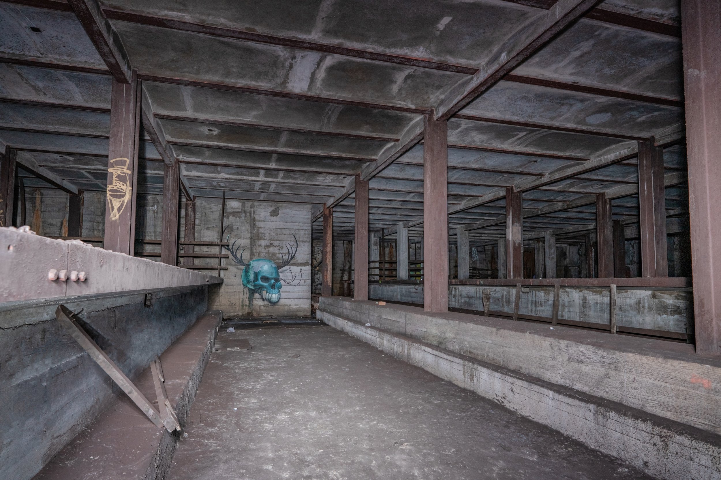
While this spot serves as an important underground yard for one of the most important lines in the system, it is rarely photographed. The MTA tends to be protective of the most important underground layups, especially tail tracks (tracks that extend past a terminal station, increasing the line’s capacity). This specific layup/train relay turns Jamaica bound F trains back towards Manhattan and Brooklyn, along with select E trains during peak hours. It is the largest tail track layup in the system, with 2 levels of 4 tracks, giving it a turning capacity of over 60 trains per hour.

However, the reason for what could be seen as the overbuilding of this tunnel is the extension that was proposed for the IND Second System. The upper level was supposed to extend further down Hillside Ave all the way to Little Neck Rd; later down to Springfield Blvd. This extension deep into eastern Queens would have been highly beneficial to people living on or about Hillside Ave, and would have relieved what are now rather crowded buses and overwhelming traffic. There have been theories that the city actually did build a tunnel further under Hillside Ave, past the concrete wall at the end of the layup.

The Awaken team went to see if these theories had any grounding. I can say conclusively, after walking down Hillside Ave for about 3 miles (all the way to 232nd St) on a rather hot summer afternoon, checking the whole street and looking for signs of a tunnel, and also going down and inspecting the end of the layup, that there is no sign of any subway tunnel having been constructed past the end of the layup.

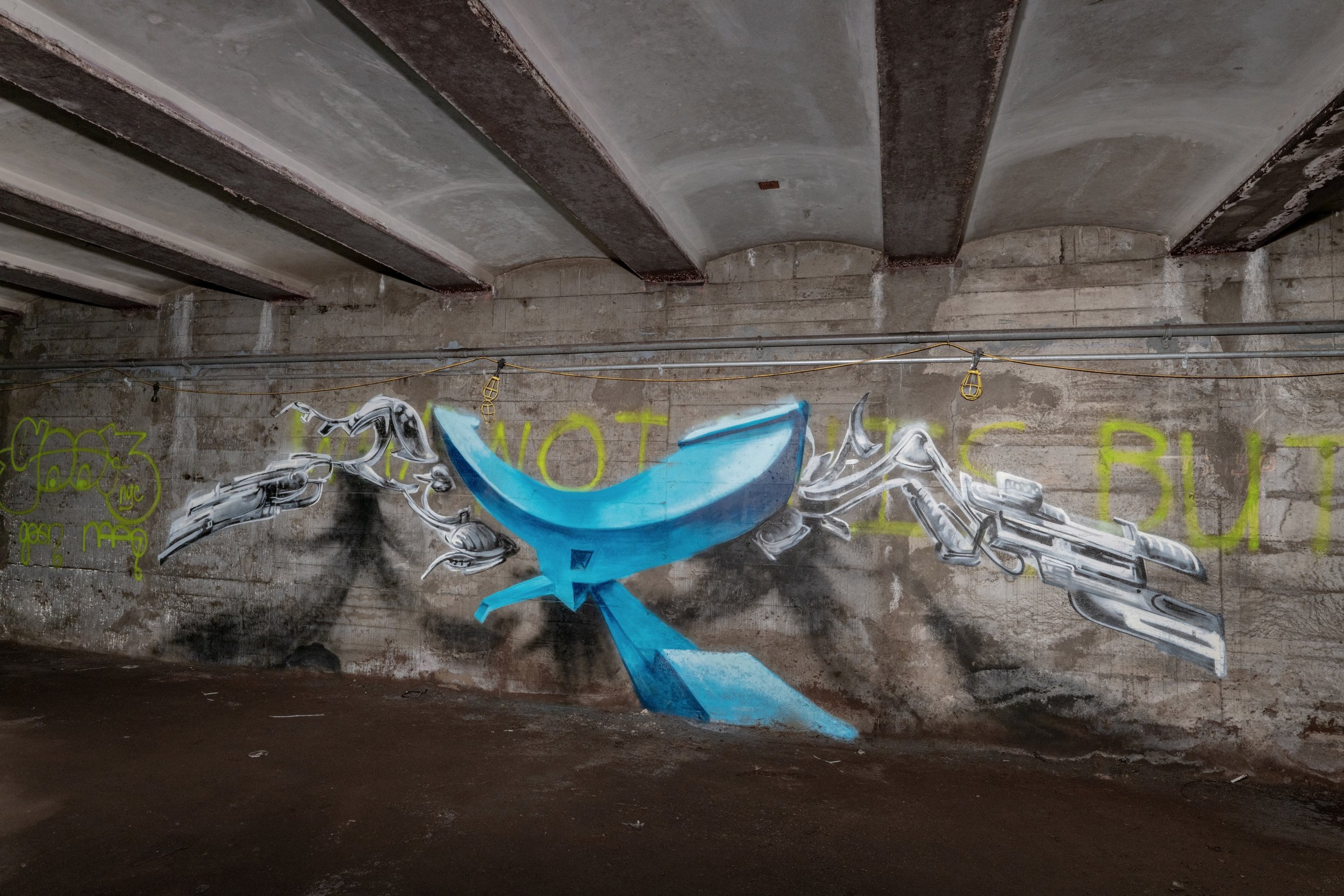
The actual tunnel isn’t very different from any other Queens Blvd tunnel, with the classic IND cut-and-cover box design and lots of brown snow. Notably, there is a lack of graffiti, aside from a few small tags here and there from legends such as Smith. A lack of heavy tagging tends to be a sign that a tunnel is special in some way, and I would say that this tunnel was no exception.

SSG 7: The Express Stop That Never Was (Updated)

As we wrap up our look at the IND Queens Blvd line’s mainline provisions, we must take a look at the express stop that never was: Woodhaven Blvd. Now a lonely average IND station, this local stop was once planned to be converted into an express stop.

As a part of the updated 1930s IND Second System plans, this station was constructed with 4 bellmouth provisions, one before and after the station on both local tracks. The intention of these provisions was to make it easier to build the tunnel out when eventually converting the station, as the local tracks would just run slightly further outside of the express tracks, creating room for island platforms on what are now currently the local tracks. The station was also built so that it would be easy to eventually lengthen the platforms.

Unfortunately for the city, the line that the reconstruction of this station would have depended on was never built. The express stop conversion was intended to allow better service to be provided to the line that the provision at 63rd Dr would have served.

Bellmouth provision east of Woodhaven Blvd

The truth is, this extra express stop is proof of just how much higher the capacity of Queens Blvd was intended to be than what it is today. The line was built to be able to serve two extensions, with the ability to someday serve four extensions if they were built. It could have even been 6 tracks for the mainline, had the super express tracks been built. Now enormous, overbuilt, lonely stations such as Woodhaven Blvd, Union Tpke-Kew Gardens, Parsons Blvd/Hillside Ave, 179th St, and more sit lonely, underwhelmed by the traffic they get now. The next post will be the last full post for the Queens Blvd line.

SSG 5: The Winfield Spur

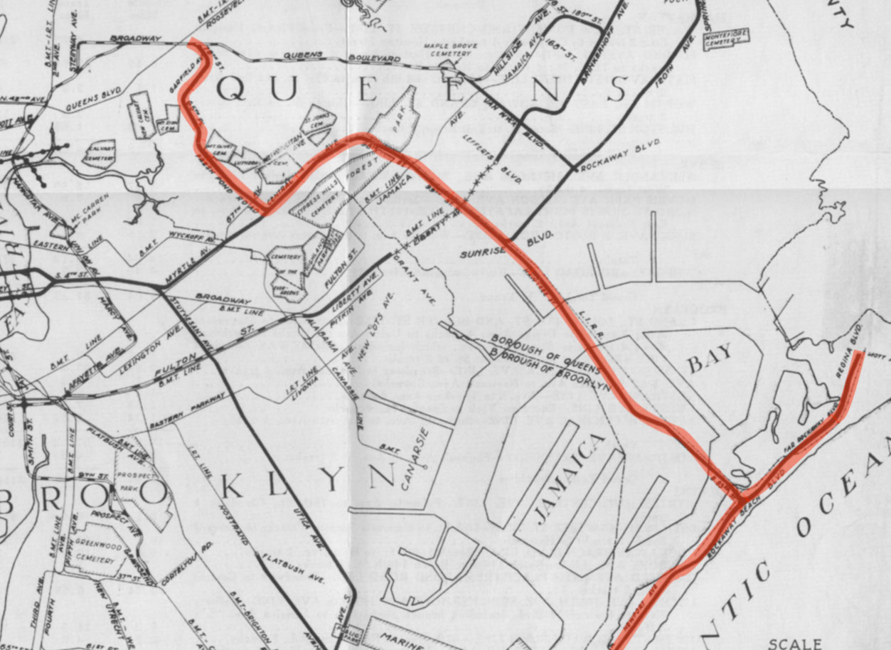
Looking at queens in terms of IND provisions, it would be impossible to neglect to mention this most notable of abandoned Second System relics: Roosevelt Ave Upper. This well known spot also may be known as the Winfield Spur. It includes a fully tiled station shell and a “spur” tunnel which runs above the Queens Blvd mainline and turns south at the east end of the provision. It was built during the original construction of the IND Queens Blvd line between 1933 and 1936, intended for full revenue service on a 2 track line going south through the neighborhoods of Maspeth, Ridgewood, and eventually the Rockaways. On the lower level, there are 2 provisional trackways hugging the mainline, which would have allowed Queens Blvd local trains coming from/going to Manhattan to run up through the Winfield Spur and join the line heading south.

The IND was serious about constructing this line—so serious, in fact, that the Roosevelt Av Upper station was actually fully tiled, unlike other IND station shells. The serious plans (from 1929) to use this station and the trackways beyond continued for nearly 10 years, dying out sometime in the late 1930s when it was decided that the new branch should extend from an area of Queens Blvd further east, near Rego Park.

The abandoned Rockaway Beach branch ROW

The line was intended to run underground through much of Queens and Brooklyn, actually joining another line which was planned to run up Myrtle Ave, branching from the S 4th St hub. After running up Central Av, the line would have come above ground to run over an already built LIRR Right of Way (the Rockaway Beach Branch). This Right of Way actually largely lays in decay now, after being abandoned in 1962. Some of the Right of Way (the bridge over Jamaica Bay into the Rockaways and the line in the Rockaways) was converted for use by the Transit Authority in 1955, and in 1956 the IND Rockaway Line (coming from the IND Fulton St Line) began operation. The (A) train now uses this southeastern branch full time, along with the Rockaway Shuttle. However, a large section of the ROW is still abandoned, and it would have been much better put to use as a subway line than what it is now: a somewhat nice place to walk and a breeding ground for mosquitoes.

As for what it is now, the space has not gone to complete waste. Although its story in terms of helping the city and the commuter, and providing rapid transit to underserved neighborhoods came to an end the way most IND Second System stories did, with the Great Depression and World War II draining the city’s and country’s resources to build rail infrastructure, the station shell is now used for storage and office space for the MTA. The tunnel does lay rotting, however. One trackway is nearly completely filled with garbage and the rest lay dark and lonely, never seeing light except from the occasional MTA worker, graffiti artist, or explorer. The construction is the standard IND Cut and Cover still, looking as boxy as ever. Also like usual, the abandoned tunnel is pitch black and extremely dirty. It is a true shame it will never get to see train headlights.

Integral Interlockings 1: Rogers Junction

As one of the most important—and most problematic—interlockings in the system, it seems only appropriate to start this series with Rogers Junction. Rogers Junction lies near beginning/end of the IRT Eastern Parkway Line (very close underneath Rogers Av on the surface), between Franklin Av and Nostrand Av or President St, depending on which way you go. It is at this point that the (2) (3) (4) (5) services join together into one line. The (2) and (5) turn south down Nostrand Av and continue a couple miles before terminating at Flatbush Av, while the (3) and (4) keep going east under Eastern Parkway just a couple stops to Utica Av.

Rogers Junction - Upper Level

Flying Junction

Rogers Junction has proved problematic over the years as the IRT chose to build it in a cheaper and more antiquated manner. A modern version of this junction would have made use of a flying junction, wherein lines only merge on the track that they need to merge on, and any other grade crossings are eliminated. The photo on the left shows an example of a flying junction outside of Delancey St/Essex St, where the (M) line merges with the (J) (Z). Although the routes are simpler here, the principle is the same and could be applied at Rogers. With the current service pattern of the Eastern Parkway line, the (5) merges with the (2) (3), and then the (2) and (5) switch to the Nostrand Av line and turn south. This causes a major bottleneck at peak hours when all lines are running at capacity, especially as the (2) (3) (4) (5) remain some of the busiest lines in the system. When there is any delay at Rogers, no matter how slight, it causes bigger delays down the lines as wait times add up more and more and crowds build, causing further delays. Furthermore, when there is a malfunction, things get very complicated. Just a few weeks ago, on July 22nd, a switch malfunction at Rogers Junction (supposedly caused by extreme heat in the tunnel, which I can certainly vouch for after being there in person) caused major disruptions and service changes starting mid afternoon and running late into the night, ruining many evening rush hour commutes. (2) trains were terminating at South Ferry in Manhattan and (5) trains at Bowling Green. (3) and (4) trains were running express on all of Eastern Parkway with extreme delays due to a slow speed order in the vicinity of Rogers Junction. This cascade of problems, at least for the most part, could be avoided with a rebuild of the interlocking.

Unfortunately, there are only really two solutions. The interlocking cannot simply be reconfigured. Not only would it be obscenely expensive to do so (the full reconstruction option costing nearly $1.6 billion and the lesser option still over $340 million), but it would also require at least a partial demolition and rebuilding of Eastern Parkway on the surface, and the tunnel would have to be completely reconstructed. On top of that, both the Nostrand Av and President St stations occur within extremely close proximity to the interlocking, meaning one, if not both, of these stations would need to be closed in order to rebuild the junction. The other solution would be to change the service pattern of IRT Brooklyn trains. Some (3) trains would be sent to Flatbush Av and the (5) would always be sent to Utica Av via the express, so the (4) and (5) would continue down the Eastern Parkway express while the (2) and some (3) trains would go down Nostrand Av, and some (3) would stay on the Eastern Parkway local. This would eliminate the bottleneck and allow the lost train capacity on the Brooklyn lines to come back, but it would be unfavorable for Nostrand Av Line residents and is probably less likely to be pursued than an incredibly expensive reconstruction.

No matter how many problems it causes, there is no denying Rogers is one of the most important interlockings in the system, which is demonstrated by the level of disruption it has the potential to cause.

Click here to read the official study done by the MTA for the rebuilding of Rogers Junction.

Click here to see the systemwide track map.

SSG 4: The East Broadway Provision

Continuing down what would have been the IND Worth St Line, one crosses the East Broadway (F) station. East Broadway would have run nearly directly perpendicular to the Second System line heading toward Brooklyn. As such, East Broadway was originally planned to serve as a convenient transfer point and a station twice its current size. One may notice while walking through the station that there are numerous dark and dirty staircases locked behind gates, and many locked doors in the public mezzanine. This is because the public station is but a husk of what was constructed.

The station was actually built with a full length intermediate level mezzanine which is also a provision for a station for the Worth St line. Tracks and a platform would have extended West-East in the middle of this intermediate level, perpendicular to the active station. As stated in the previous post, the line would have been highly beneficial to Brooklyn commuters, bringing full subway service to “transportation deserts” and also taking pressure off of elevated lines and more unreliable two track lines such as the (L). From this station, trains would have continued through a new crossriver tunnel into Williamsburg, into the S 4th St hub.

Below the provision, the East Broadway station is heavily deteriorating and will probably be due for a Station Renovation or Enhanced Station Initiative soon. Like other (F) line stations, especially on the Lower East Side, the station is regularly inhabited by the homeless and overwhelmingly reeks of urine in many areas.

The provision itself is rather dark and dirty, covered in “brown snow”. A portion is tiled like any plain IND mezzanine would be. The space is now used for storage and break rooms by Stations personnel. While this area will probably never see revenue service or customers, it is certainly cool to look at, especially being rarely photographed.

SSG 3: IND Worth St Line Provisions (Updated)

Another highlight of the IND Second System was the IND Worth St Line. The Worth St line would have been fed by 8th Av Line trains and would have fed to other major IND Second System lines, making it a key component of the whole plan.

Provisions were built for the IND Worth St Line during both original IND 8th Av line and IND 6th Av line construction, though this post will focus on the provisions constructed on the 8th Av line.

Bellmouth on northbound track

Bellmouth on northbound track

These provisions (empty tunnel bellmouths within the active tunnel) would have allowed the line that terminates at Chambers St-World Trade Center, currently the (E) line, to instead continue East across Worth St, through a new crossriver tunnel, and through the S 4th St station hub and under Myrtle Av or Stuyvesant Av and Utica Av in Brooklyn. This new subway in Brooklyn also would have been fed by trains coming from 6th Av, through the provision for a crossriver to Brooklyn at 2nd Av.

The state of this place today is not unlike other IND Second System provisions, being dark and water damaged in some areas. In this tunnel, the tracks split into two levels, in order to allow the (E) to move into its own terminal platform and the (A) and (C) to continue to Brooklyn on their own separate platform. The southbound (C) merges onto the (A) express track, while the (E) local track sinks underneath and crosses below the southbound and northbound express tracks to come up adjacent to the northbound local track. The provision for the Worth St line extends from both local tracks on both levels, the upper level one (shown) being slightly shorter than the lower level.

Bellmouth on southbound track (lower level)

Technicalities aside, the Worth St Line and various Brooklyn lines it would have fed would have greatly benefitted the city, and it’s a shame that a combination of unfortunate circumstances prevented their construction, along with most of the Second System. Today, these lines and provisions still hold relevance, as the MTA and the public have recently reopened discussion of a Utica Av subway in Brooklyn, with the MTA reviewing the feasibility of extending the IRT Eastern Parkway Line in Brooklyn south down Utica Av (the IRT also included a provision for a Utica Av line at the Crown Heights-Utica Av station—but that is a story for another series). Unfortunately, I don’t think we will ever see any of these proposed lines constructed, certainly not any time soon. However, it is nice to appreciate the ambition that the city once had for new subway construction at a time by admiring the forward thinking construction of the IND “First System” lines.

SSG 2: Abandoned LES Tail Tracks

This tunnel is one that feels special to me, and it may be very hard to justify. It’s dirty (very, very dirty), pitch black, sealed up tight, hot, and stuffy. It’s long abandoned, having been sealed up in the 70s. The station that it stems from is infested by the homeless and always smells strange, if it doesn’t smell like urine. It also can get very crowded, being one of the only stations to serve the LES.

Why is it even worth bothering with, then? What makes it special in the grand scheme of things, and what makes it special to me personally? At a glance the station in front of the tunnel appears overbuilt, with high ceilings, island platforms, 4 tracks, only two tracks being utilized. However, there is more to the story.

To start off, exploring this place is not as straightforward as it seems. What seems like a simple two track tunnel is actually an enormous space, filled with several more trackways, lots of empty space, and many small rooms and side areas. At the end, on what would have been/was the Manhattan bound/Northbound track, there is even a (somehow) working signal, left over from the tunnel’s days of being active tail tracks. The two tail tracks are still down, though the third rail is disconnected from power and the tracks are covered in a layer of “brown snow”, or tunnel dust. The station before the tunnel was built with unusually high ceilings as a provision for the Second Avenue Subway, another relic of the Second System plans which has, contrary to the trend, actually come partially into existence.

While there is evidently some neat stuff to see here, the tunnel was supposed to serve a much more important purpose than satisfying the eyes of the few. It would have connected completely new lines in Brooklyn (including the S 4th St line/hub aka Underbelly—the topic of the last post—and the Utica Av line which is still discussed to this day) directly to the 6th Av line in Manhattan. Trains would have run through a new crossriver tunnel spanning from the Lower East Side to Williamsburg. This tunnel would have not only been beneficial to Brooklyn commuters for the past 80 years, but it also would have created a great alternative route to the L line between Manhattan and Brooklyn, helping to avert the problems with the L that have arisen over the past 15 years, from overcrowding to the shutdown problem.

Unfortunately, this tunnel lays dormant as just another relic of the IND Second System plans, destined from the start to be abandoned due to a lack of funds. However, for many years it was used in active service, the tail tracks used for train storage and relays, as the 6th Av line either ended here or continued through the Rutgers St Tubes into Brooklyn to merge with the Crosstown Line. 6th Av express trains, along with select local trains and more during service changes, used to terminate at this station and hence made use of the center tracks in the station and the tail tracks. The Chrystie St connection greatly changed service patterns throughout the system, most notably creating a new route for 6th Av express trains to connect through to Brooklyn’s BMT 4th Av and Brighton Lines, and a route for 6th Av local trains to connect to Brooklyn’s and Queens’s BMT Jamaica Line. As a result, the center tracks were taken out of active service and the tail tracks were abandoned following the completion of the Chrystie St connection. When the homeless began to inhabit the tail tracks during their abandoned time in the 70s, walls were built around the perimeter of the tunnel, blocking it off from easy access.

View of the end of the tail tracks, including the still-lit signal, bumpers, old tracks, candles, and a friend.

My thumb didn’t feel too good after lighting around 50 candles (luckily I had some help, as we used 100), so I hope you guys enjoy the photos!

Second System Gems 1: The Underbelly

South 4th St, better known as the Underbelly Project, is a “station shell” built by the IND during the construction of the Crosstown Line, completed in 1937. Station shells are provisions for future expansions of the subway system, mostly built by the IND, which was the original subway company run by the city. They are all built somewhere in the vicinity of an active station, and were built in anticipation of plans for the future, so that active subway stations wouldn’t have to be completely gutted while building new intersecting lines.

The station shell

Historically, this spot has some significance. It was built to eventually be integrated as an enormous hub into the IND Second System, a plan which would have doubled the size of the city’s subway system, but the city continued to run out of money and almost the entire plan was scrapped. To this day, we see what the benefits could’ve been for developing neighborhoods that would be on lines branching from here, along with various other Second System provisions. Now, spots like this lay decaying and covered in “brown snow”, our name for the subway dirt mostly composed of steel dust. The only plans from the Second System that actually materialized in some form were the 63rd St Tunnel, the stub of the Second Avenue Subway that opened several years ago and that construction will continue on for the foreseeable future, the Chrystie St Connection, the Jamaica Archer Av Extension, and the 6th Avenue express tracks. 

More recently, the Underbelly Project was completed by 2010. This art installation was a covert operation, involving over 100 artists being escorted into the station shell in the middle of the night. Everyone involved swore secrecy, creating a sort of secret forbidden art gallery underground. Upon completion, the “curators” removed their means of access and sealed up the spot, but word soon got out and hipster photographers flocked to the spot.

The usual shot people take

I always found interesting the lengths people have gone to and continue to go to in order to get inside this place. The MTA and NYPD have repeatedly cracked down on people visiting this place, resulting in arrests and heightened security (the peak being the installation of a cinder block wall over the old passageway leading in and a metal gate over the old doorway, along with motion sensors within). I personally am of the opinion that this spot is overrated, while there are many other great tunnels, but it may have been a better call by the MTA to try to preserve this place, possibly making it an underground gallery of sorts open to the public. People have flocked to this place since the Underbelly Project became publicized, for reasons ranging from a lack of creativity when taking photos to clout chasing to just trying to find an easier spot to get into that serves as a “cool” underground urban photo studio. Some have even come to the spot in order to destroy the artwork on the walls. However, there are some who are curious about the history of places like this, and I am thankful to those, as they help keep the history alive. Even by reading this and hearing what I have to say, you help to continue the story of this spot. Enjoy the photos.